What does exactly an "adventure ride" entail? It's really an individual thing, but an "adventure" generally involves getting out of one's comfort zone, doing something against one's self-preservation instincts, something dangerous, potentially deadly, and, hopefully, getting away with it. So, adventure riding can be riding rough, remote, rarely used, back-country roads and, possibly, camping in the wilderness in one's own backyard. It can mean going to a far-away, unfamiliar country and riding overcrowded roads where traffic rules as we know them mean nothing. It can also mean passing through dodgy areas or having to deal with corrupt officials bent on extorting money from travelers. Often times, an adventure involves several or all of these factors.
Looking back at more than half a million kilometers that I have ridden on different continents, there are really only four rides that I would classify as true adventure rides. They were multi-days rides, traversed remote, desolate areas with at least some technically challenging riding sections.
There are four most memorable adventure rides:
- BR-319 - Brasil's forgotten highway through the Amazon;
- Australia's Great Central Road;
- Tajikistan's Bartang Valley;
- Cassino Beach Ride - world's longest beach;
and three honorable mentions:
BR-319 - Brasil's Forgotten Highway
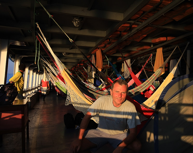
Santarem to Manaus Amazon boat ride - I was the only person without a hammock.
I've heard about this disused highway during my first ride around Latin America. One rider's report left particularly sacring memory on me - he fell down one of the broken bridges and broke his neck. Just getting back to relative civilization where he could get some basic medical help was an ordeal. It took him a while trying to recuperate enough to extract himself from the predicament. That account really opened my eyes about just how wrong things can go on this road.
I timed the rest of my S. American travels according to hitting BR-319 at the right time (dry season). I arrived in Manaus on a boat from Santarem (after 3 days of fighting trucks and dust on Transamazonica, I opted for the boat ride).
I enjoyed Manaus and rode up to the Equator one day. But then, it was time to face the formidable BR-319 and its 500km of badly damaged bridges without any services or villages along the way. I bought two 20l fuel canisters to bring along.

Equator is a few hour ride north of Manaus.
Finally, it was time to leave the comforts of Manaus and cross mighty Amazon on a ferry. It seemed they were working on building bridges along the route, but after 50km, all activity seemed to have died out.

The big ferry across the Amazon in Manaus.

One of the smaller boats along the route.
After a few more small ferry crossings, I was getting deep into the adventure. It had been hours since I'd seen the last person. Now I was completely on my own for the next 400km or so.
I did choose to ride in the midst of the dry season, so there was no mud to deal with. Apart from damaged bridges, it wasn't such a challenging route to ride from the technical standpoint.

A typical bridge along the route.
I ended up spending two nights on the route. Both nights I spent behind wired fence of communications towers ( that was recommended by other riders as a safety measure for jaguars). One night, while sleeping in my tent, I saw car lights approaching. After few minutes, the car turned around and left. It must have been communications maintenance crew. Other than this car at night, the only people that I saw in the three days on the road was a Polish couple riding their motorcycle in the opposite direction.
Eventually, I pulled into Humaita, overflowing with happiness and sense of accomplishment. I survived BR-319!
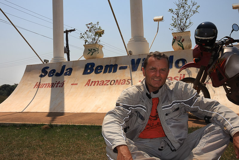
Tired and stinky, but happy to have made it to Humaita.
This ride is on the list of particularly memorable adventure rides because:
- It traverses extremely remote, undeveloped and desolate area with virtually no people to offer help;
- Challenging, unknown conditions of unmaintained bridges;
- It is a multi-day ride, and
- Self-sufficiency is a must (bring extra fuel and water).
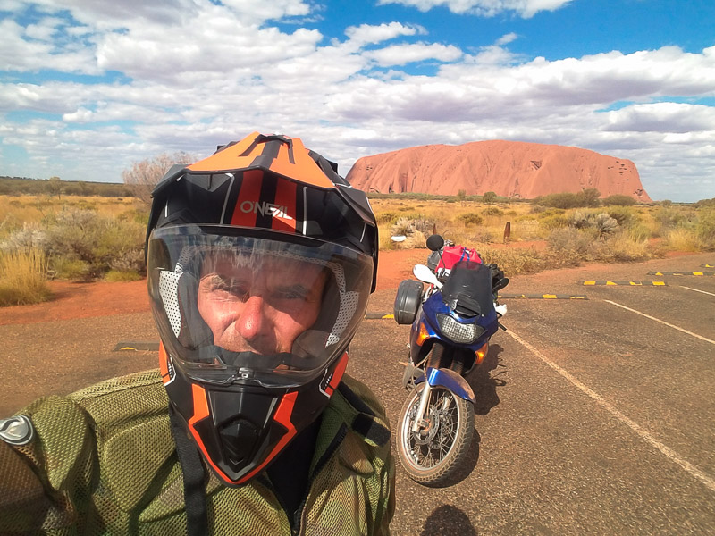
Australia's Great Central Road
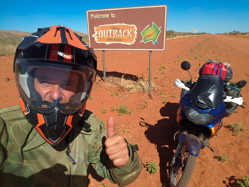
Outback - what Australia is famous for.
Australia may mean a lot of things - Great Barrier Reef, Sydney, Kangaroos, but for me, it meant red, hot interior and one road cutting through - the Great Central Road. There are hardly any vehicles along the road and when one comes along, it's most likely to be a road-train, going at a high speed, stopping for nobody, better-get-out-of-the-way kind of encounter.
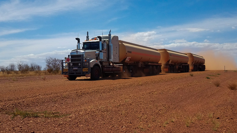
Road Train - the king of the Outback.

It's 1600 km of red Australian heartland from Laverton (the last town) to Alice Springs.
I happened to ride the Great Central Road in the summer, at height of the heat and there were virtually no other travelers. There are only a few filling stations, mostly serving local aboriginal communities. Alcohol is strictly prohibited in this area, not only to buy but also to bring in.

Australian Outback art, or just a bilboard.
Once again, I purchased a canister to carry extra fuel as my bike's range wasn't sufficient to make it between petrol stations. I inquired about the road conditions ahead at the last information center and started my journey.
The biggest hazard on this road were bull-dust pools (some people call them dry mud) - pulverized dust, so fine to make handling bike extremely difficult. They are not easy to see, especially when traveling at speed.
What I found to be the single biggest problem, that nobody talked about, were black flies. There were billions of them and they all wanted to get into my eyes, mouth, nose. So, I ended up wearing helmet even when stopped. The hardest part was eating, when I had to get the helmet off and flies would swarm onto me with no interest in food, whatsoever.
It took me three days of riding to get to Ayers Rock, but I couldn't take the helmet off even to take a selfie because of black flies.
Sleeping wasn't a problem as there was hardly any traffic or people around. I camped for two nights, safe from the flies behind the net. The only issue was sleeping on scorching hot soil.

One of the camps along the route.
Eventually, I arrived at Ayers Rock and paved road. When I saw busloads of tourists, every single one of them with a head net, I realized how poorly prepared I was for the black flies of Australia's interior. In any case, I enjoyed the sense of accomplishment - Great Central Road checked off.
This ride is on the list of particularly memorable adventure rides because:
- It traverses extremely remote, undeveloped and desolate area with virtually no people to offer help;
- While the road is mostly in good condition, there are bull dust pools that can surprise;
- It is a multi-day ride though a desert with heat exhaustion being a serious concern, and
- Self-sufficiency is a must (bring extra fuel and water).
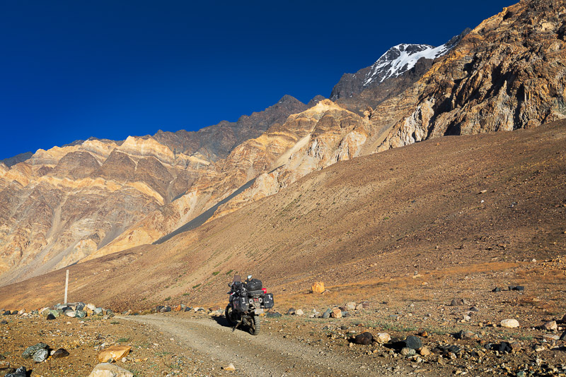
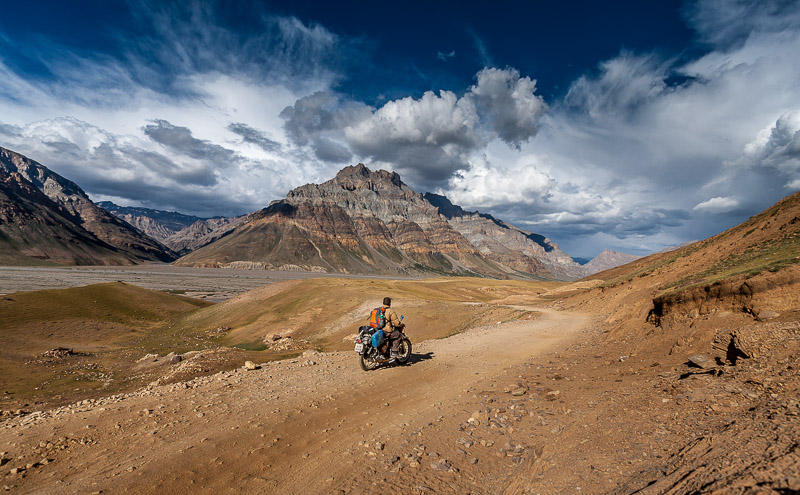
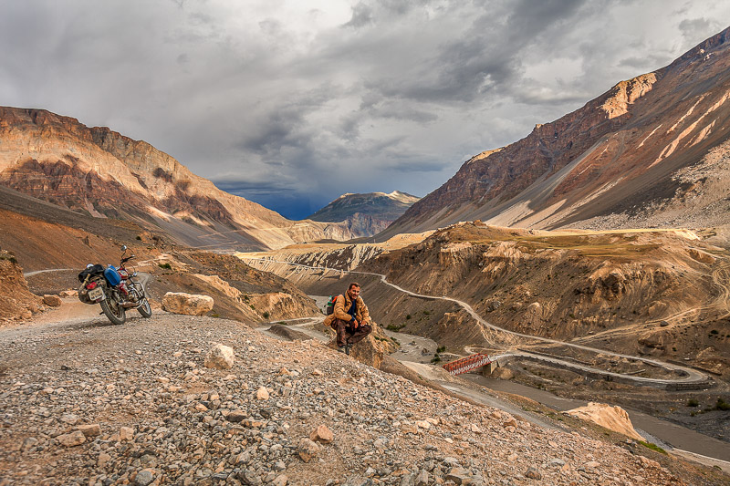
Tajikistan's Bartang Valley
Bartang Valley displays raw beauty from the start.
When I planned a ride to Mongolia, I realized that there is just too much to see and do in Central Asia that I better devote a whole trip just to it. Even though I did some research about sights, places to visit and roads to ride, it wasn't until I got to Tajikistan that I learned about Bartang Valley.
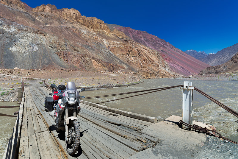
Bartang Valley roughly parallels Pamir Higway, meeting it on both ends. Floods and landslides make travel through Bartang valley rather unpredictable as the conditions can change overnight. Additionally, there are a few really tough sections and several sketchy creek crossings.
Yes, even cars can go over this bridge.
While there are some villages in the lower part of the valley, further up, there is nothing and virtually no traffic. So, if one were to have a medical emergency or if the vehicle were to break down, it could be days if not weeks before someone came through to offer help.
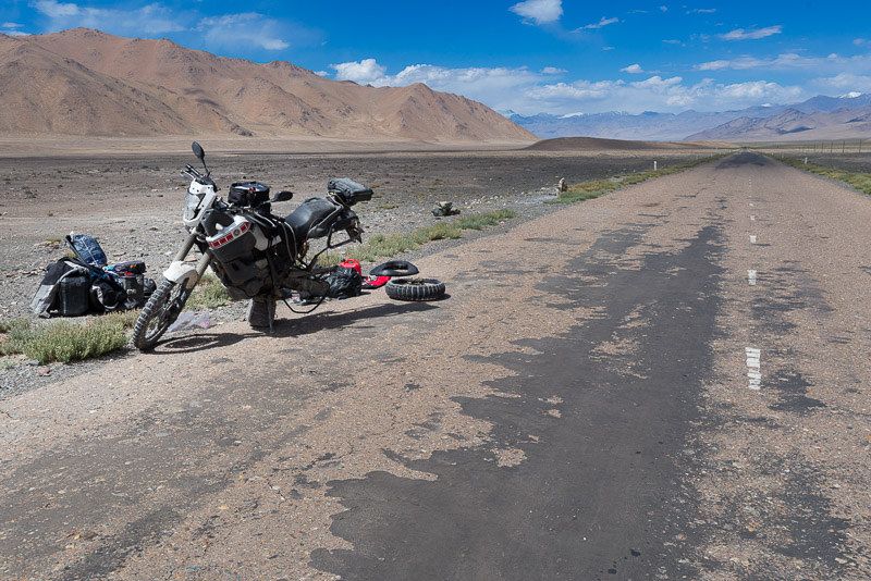
It's over 400km between petrol stations on both ends, so, as usual, I carried extra fuel in a canister and few soda bottles.

I learned in India that soda bottles are great for carrying extra fuel.
Having filled up the fuel, I headed into the valley. I had a breakfast at a hose along the way. I think locals haven't jumped on the tourist bandwagon yet. So, one can simply ask for a meal or accommodation in any house along the way.
Towards the end of the first day, near a military check point, I had a flat. One of the guards, having seen me wrestle with the tire, came over to help. Two hours later, I was able to continue. Soldiers at the check point told me that the road is impassable due to landslide. I was a bit worried by the news, but I wasn't gonna turn back.

Fixing the flat tire by the military check point.

The river often floods sections of the road.
The night caught me near the last village of the valley. I set up the tent and just as I crawled in, a girl from the village came over to invite me for a tea. I realized that I could have had dinner and bed to sleep in, but it was too late to move.
Even though the road got pretty rough near the last village, the most challenging riding lay ahead - about 100km of deserted valley and then climb out onto the plateau.
One of the last villages in the upper reaches of the valley.
Amazing color of surrounding mountains in the late afternoon sun.
Not too far from the village, I came to the "impassable" section. Yes, it was impassable for any vehicle with more than 2 wheels. But it seemed doable with a motorcycle. So, I proceeded ever so gingerly as any slip would at least bike lost on the raging river.

The section of the road impassable for cars, but motorcycles could still squeeze through. I couldn't stop to take a photo at the narrowest section, which was no more than a foot wide. Loosing bike in the river at this point would mean a long hike back to the last village and then probably several days of travel to "civilization"
With a sigh of relief, I proceeded deeper into the valley. I hoped I would not have to reverse the landslide section.

The valley widened up and wound its way up to the base of a 7000m peak.
As expected, there were several creek crossing, for one of which I had to take all of my luggage off, carry it over and ride an empty bike across. In retrospect, it wasn't such a hard crossing, but it was hard to see what was lurking in muddy waters.

The river crossing where I had to take luggage off and ferry it to the other side.

Other river crossings were much easier. I had to remove windscreen because I lost one bolt and it rattled too much
Finally, the road started climbing up and out of the valley. That was a welcomed sight. The main Pamir Highway and "civilization" were up on the plateau. That's when I noticed that my "repaired" tire still had a leak. I stopped a few times to add air and I limped onto the paved highway. Even though I was worried about leaky tube, I was relieved that at least I reached a place where there would be help if I needed it.
I found some big rocks, propped bike onto them and started working on fixing the tire. During two hours that it took me to change tube, only one bicycle rider and one car passed by. Bike rider offered help and car driver made sure I had enough water. Out there, people watch for each other as it's an extremely inhospitable environment.
Second time I had to fix a flat tire in 2 days. During the two hours that that it took me to repair the tire, only one bicycle and one car passed by, both offering help
Once the tire was fixed, I decided to ride back to Khorog in order to ride the Wakhan corridor road.

On my way back to Khorog.
This ride is on the list of particularly memorable adventure rides because:
- It traverses extremely remote, undeveloped and desolate area with virtually no people to offer help, especially after the last village of the valley;
- Challenging riding, flooded, and washed out road with sketchy river crossings
- It is a multi-day ride, and
- Self-sufficiency is a must (bring extra fuel and water).
Cassino Beach - ride world's longest beach
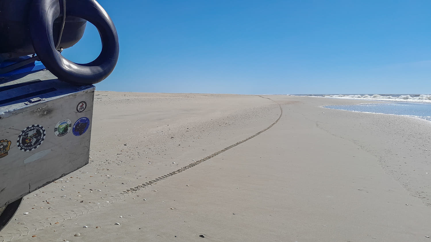
200+ km of solitude along World's longest beach.
While riding around Brasil on my second motorcycle tour of the continent, a friend mentioned that he had ridden world longest beach in Southern Brasil. I made a mental note and did a bit of research about it.
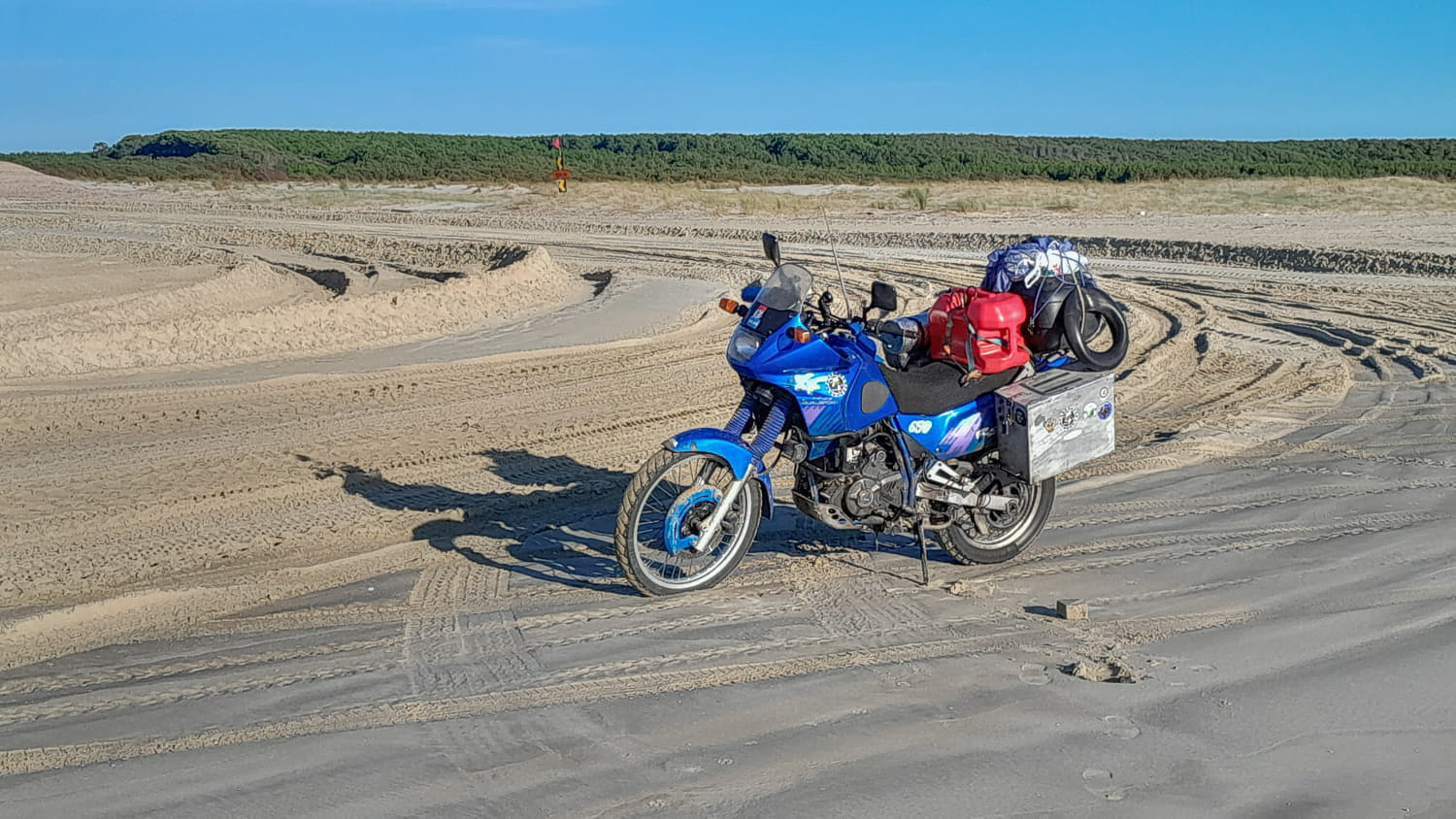
World's longest beach is indeed in Brasil, near the border with Uruguay - Cassino Beach. Brasilians love riding/driving on beaches and I had the opportunity to ride on several long beaches in Brasil. But this was an exceptional adventure - over 200km of pure solitude, not to mention changeable sand conditions and tide timing.
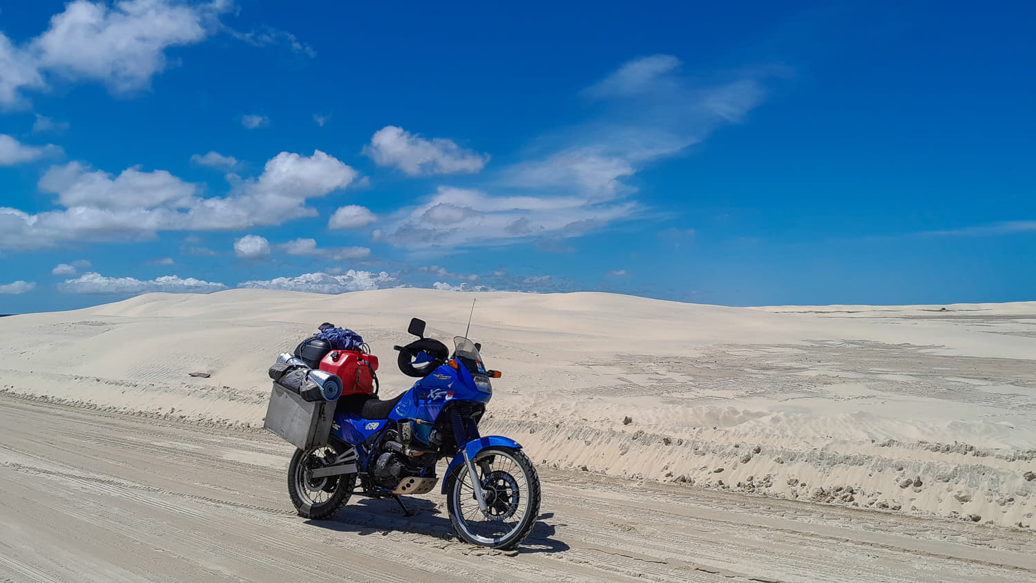
There are hundreds of kilometers of empty beaches just to get to Cassino Beach.
After visiting friends in Porto Alegre, I thought it would be a quick ride to Cassino Beach. As usual, I underestimated the size of this country. I got to Cassino beach at late afternoon. I had hoped to ride at least half of the beach that afternoon, but with the late start, I barely made 20km before sun set.
Even 20km into the ride was enough to allow me perfect solitude and tranquility. There was nothing but the sound of surf and stars of the southern sky. I camped a bit further away from the surf line as I didn't want to wake in the middle of the night soaked by encroaching tide.
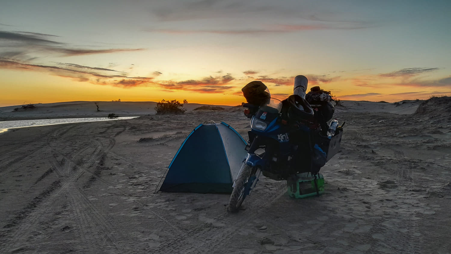
I found a nice place to spend the night.
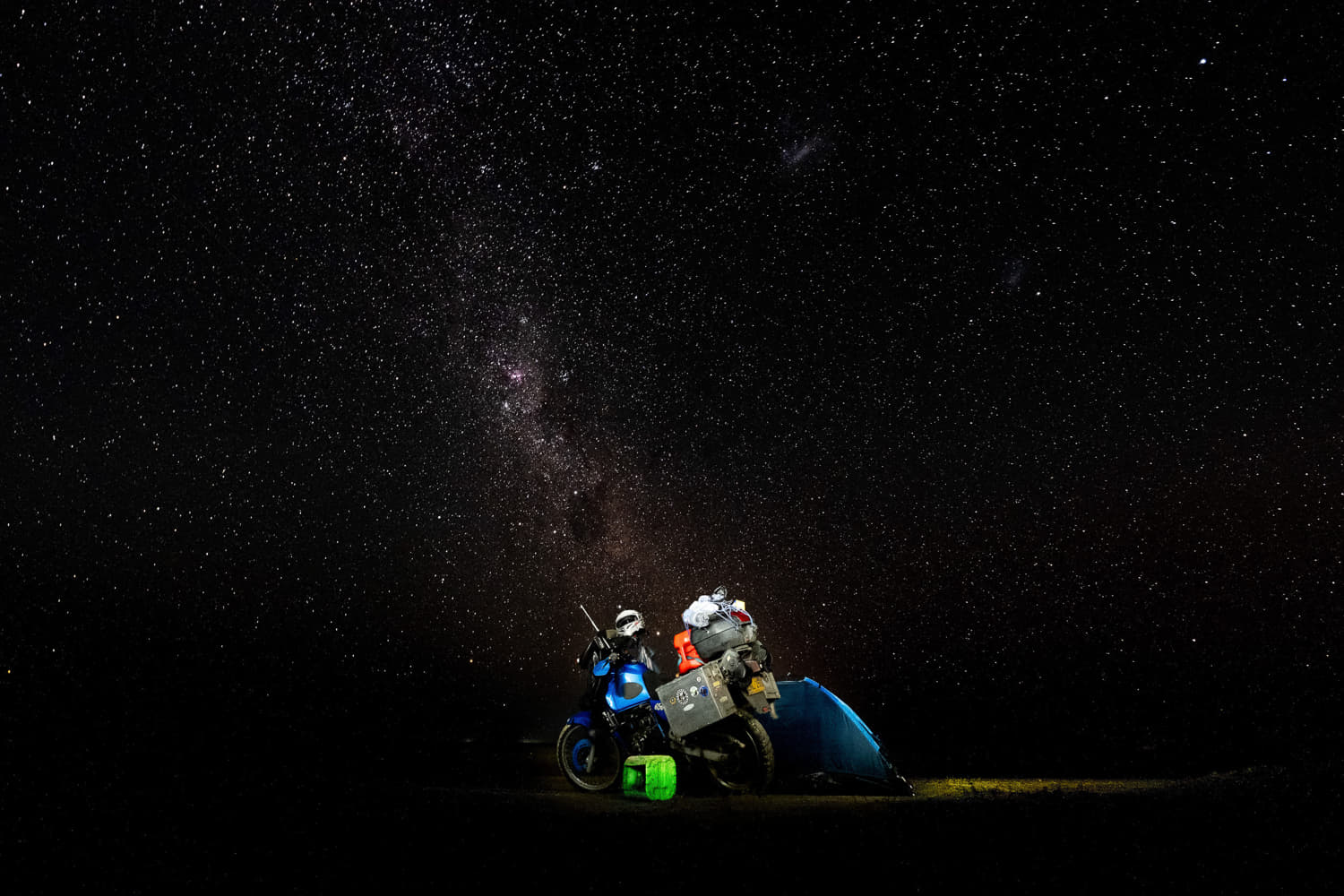
At one point, I woke up in the middle of the night and went out of the tent to enjoy starry sky over southern Atlantic.
As my luck would have it, neither the sand conditions nor time timing were in my favor that day. One couple in a 4x4 stopped to make sure I was ok. They told me that the current wind conditions bring soft sand onto the beach and make it harder to ride/drive. Tide timetable didn't offer any better news - low tide at midnight and high tide at noon, exactly the opposite of what I was hoping for. But, I wasn't gonna wait for a week or two for tide to reverse timing, so I pushed on.
Next morning, I woke before sunrise to have as much time to ride before high tide. The ride was fairly fast, on hard packed sand near the surf line, till about half-way point. A lone lighthouse was the last sign of humans till Uruguay border.
The last side road. After this, I will be riding for over 100km between the ocean and a long inland lagoon.
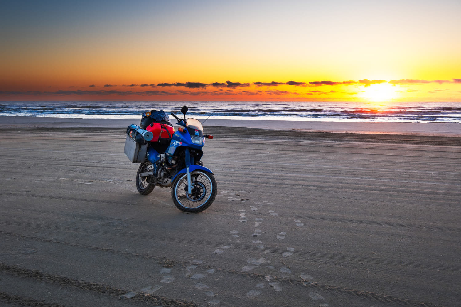
When the sun popped up above the horizon, I was already riding.
After the lighthouse, sand conditions started deteriorating steadily. Several times I tried riding deeper in, away from the ocean and I barely got back. The sand was too deep.
The strip of rideable sand, between the surf and deep sand was getting narrower and more inclined (harder to ride). On several occasions I got splashed by waves. If the surf were to reach soft sand, I'd have to park away from the ocean and wait for the tide to drop down in the evening. It wasn't the best scenario, but I had enough water to survive one day on the beach.
While riding this utterly desolate stretch of beach, I saw many carcasses of sea lions, sea tortoises and even one whale, decomposing on the beach. It was bizarre to say the least, but I didn't have time to stop and take photos, I just kept on riding as fast as I could.
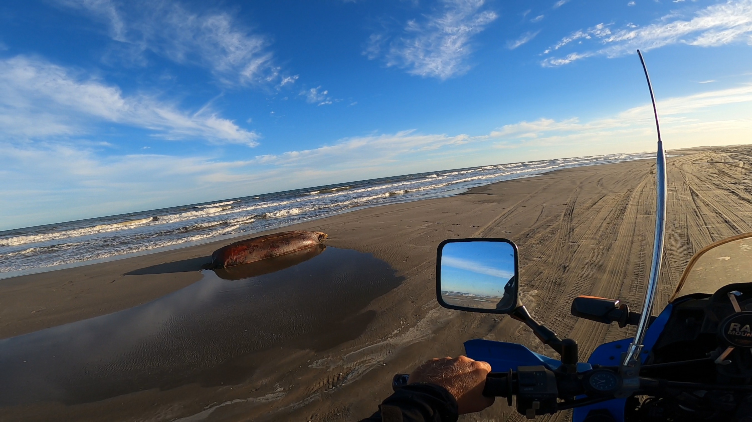
At first, I thoguht this sealion was just basking in the sun.
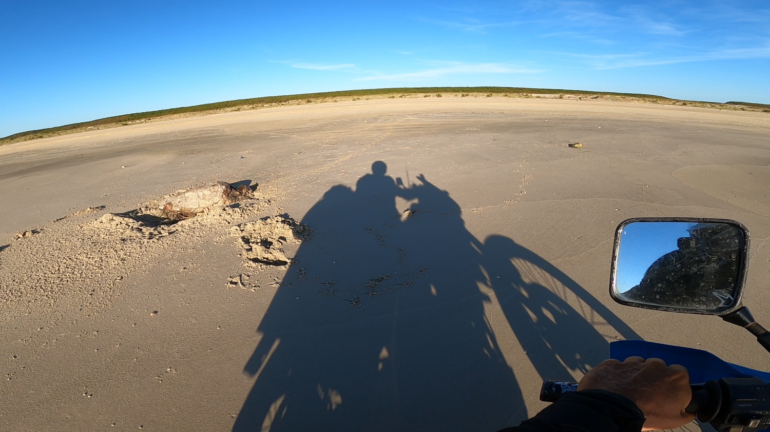
I saw so many of these tortoises. I don't know if they are supposed to die after laying eggs like salmon or if this was abnormal.
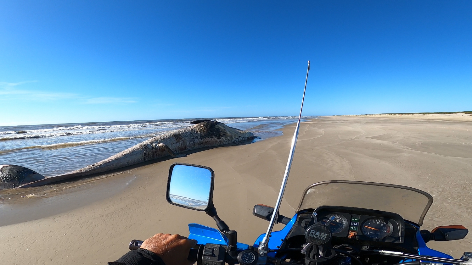
This whale was most certainly dead and not for very long time.
Having passed several sections where I almost got stuck in the sand, I started seeing signs of humans - trash, shacks and then cars. I knew I made it. Eventually sand got firmer and rideable area wider.
Once again, the overwhelming feeling of accomplishment was the best reward for the effort required by this ride.
Video of the Cassino Beach ride.
This ride is on the list of particularly memorable adventure rides because:
- It traverses a desolate beach with virtually no people to offer help;
- Challenging and unknown conditions of the sand, variable tide;
- It is a multi-day ride, and
- Self-sufficiency is a must.
While not exactly as thrilling or rewarding as the rides mentioned above, following rides are still worth mentioning.
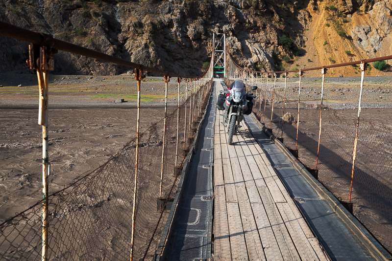
Wakhan Corridor

After the last village of Wakhan valley and military check point, the road becomes little more than a faint track and snowy Himalayan peaks of Pakistan and Afghanistan dominate the horizon to the south.
While similar to Bartang valley ride, I would not call this route an ultimate adventure ride simply because it is technically easier, there are more people along the route and it requires less commitment.
Wakhan corridor was left as a buffer zone between Russian and British empires - a narrow spit of land between Tajikistan and Pakistan, that officially belongs to Afghanistan even though people living there have little to do with Afghanis. Today, it is mostly a destination for adventure travelers along Pamir Highway.
Apart from having to secure a permit and bring enough food and fuel, there are no major challenges along this route. There are some settlements in the lower part of the valley and some hot springs further up. Locals are very friendly and, I'm sure, would be more than happy to help anyone in need.

What was raging river further down in the valley is an ankle-deep stream up here. The other side of this stream is Afghanistan and not much further up the road is China.
Still, savage mountains, raging river, proximity of fenced Chinese border and out-of-this-world feel of the place make it a rather memorable ride. I spent two days riding it. I slept near the upper end of the valley, where river forming border with Afghanistan was ankle deep. I spent a few hours soaking in a hot spring further up before continuing towards the border with Kyrgyzstan.

On the way out of Wakhan Corridor, towards Pamir Highway.
Croton Road

At the edge of the mesa where Croton road descends towards Lake Powell.
Even though this is one of the most remote areas in the lower 48 and I never saw anyone else on Croton road, it does not qualify for the ultimate adventure ride simply because it's not long enough. It can be easily done in one long day.
Grand Staircase Escalante NM is one of the last large undeveloped areas of the US. There are several dirt roads making shortcuts between US-89 and SR-12. Croton road is the roughest and most remote/long of them. It passes Mesa Romana and Grand Bench Mesa before climbing up onto the plateau. On the north end, it drops down into Left Hand Collet Canyon, which in itself, is a spectacular section.

Out-of-this-world scenery along the road from Big Water to Croton Road.
Solitude can be easily found throughout Grand Staircase Escalante NM.

One of the "wild" access points to Lake Powell near Mesa Romana.

Mesa Romana - one of the most scenic spots around Lake Powell.

Left hand Collet wash connects Croton road and Hole-in-the-Rock road.

One of many connecting roads in Grand Staircase Escalante NM.
Video of what it's like to ride in Grand Staircase Escalante NM.
Indian Himalayas
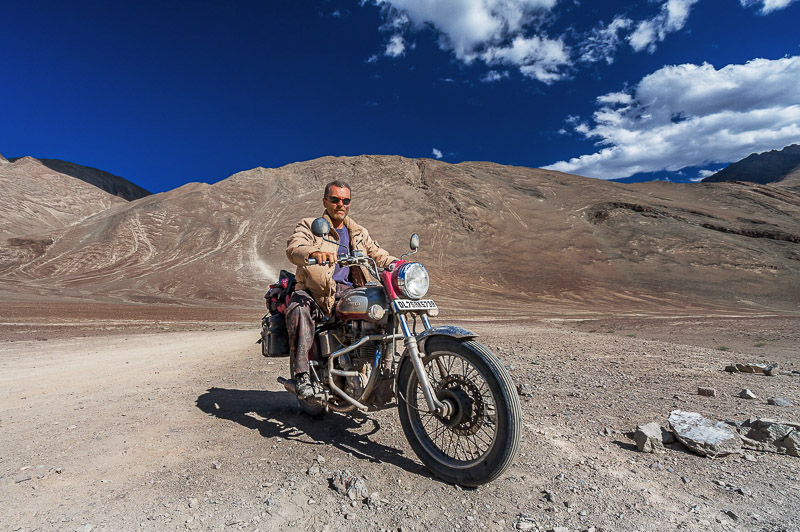
Riding in Laddakh, place like no other.
While even scooting around a neighborhood in India qualifies for as an adventure ride, my ride through Indian Himalayas didn't require camping. Even though I traversed very desolate areas, every night I found a place where I had accommodation.
After a day of looking around for bike to rent in New Delhi, I set off on my adventure before the morning traffic. First two days of riding from New Delhi through the plains heading NW towards Jammu were not particularly interesting.
But after Jammu, the road started climbing up into the mountains and scenery became a lot more interesting. At first it was alpine - green meadows, pine trees and lakes. But after I got deeper into the mountains, the scenery got drier and more raw. Srinagar and the nearby Dal lake were the last of green sights I will see in a while.

There are many Tibetan monasteries scaterred along mountain ridges.
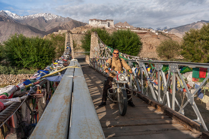
Tibetan prayer flags are everywhere.
Road to Zanskar valley. I didn't make it all the way because of insufficient fuel (apparently, there is no fuel for sale at the end of the valley).
There is a dead-end road to Zanskar valley branching off the main road to Leh. I bought a 10l can of extra fuel, but at about half way point, I realized that it would not be enough to get me to Zanskar and back.
Leh is a big, touristy city and there are several roads that go to different places of interest from it. One of them goes over Khardung La Pass, famous as the highest motorable pass in the world, but there is a higher one. However, permits for that one are hard to get, so Khardung La was the highest point I rode.
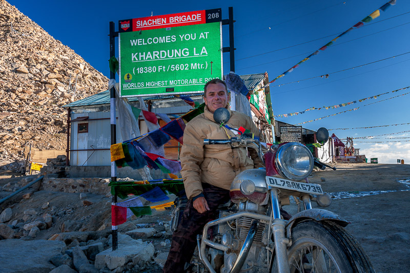
Famous spot to take photos.
On the other side of Khardung La is Nubra valley, a deep valley with hardly a plant in sight. There are a few villages in the valley that leads up to Pakistani border. Unfortunately, fuel shortage prevented me from going further up the valley. Nevertheless, the night I spent in a village in Nubra valley was among the most memorable.

Village in Nubra Valley where I spent a night.

Climbing up to Khardung La Pass.
There are two high lakes within a day ride from Leh - Pangong Tso and Tso Moriri. There is virtually no infrastructure at either lake. Only some makeshift tents for the few tourists that make it there during 2-3 months of summer. I have no clue how locals make it through the winter.

This lake is rather long and part of the lake that can be seen in the distance belongs to China.

It takes almost whole day to get to this lake from Leh, so one has to spend a night in a basic tent there.

Big sky Ladakh.

Tibetans love hanging prayer flags on every pass.
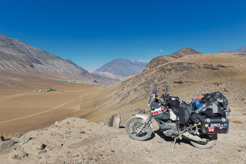
Once I made a loop visiting remote lakes, I joined the main Manali-Leh highway. "Highway" should not be taken literally here. Long sections of it are little more than a gravel road (even though improvements are under way) and it is closed 8-9 months of a year due to snow. Nevertheless, it is a famous motorcycle ride for Indian as well as visiting riders.
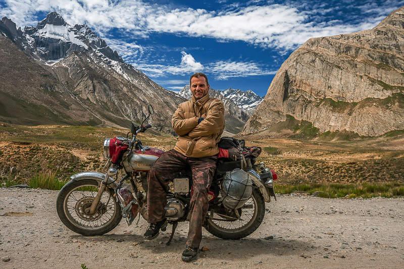
After a spectacular descent from the plateau down a series of switchbacks into a green valley and Keylong, I decided not to continue over Rohtang pass to Manali, but to take a side road through Spiti Valley to Kaza. Now this road is a rough dirt track with numerous river and creek crossings and sometimes running over a baby head boulder field.
I made this decision on the spot and started this ride around noon. I underestimated the technical difficulty of the road and how much time it would take me to get to the next town - Kaza. I wish I had more time or my tent with me so as to ride slower and enjoy the spectacular scenery at leisure.
On my way to Kaza.

One of several passes on the way to Kaza.
It's getting late in the day and Kaza is nowhere to be seen.

During the ride, I saw only one jeep and one motorcycle rider.
Kaza is apparently a regional center, the biggest town after Len. It had a market, some restaurants and government offices where I secured a permit to continue along the road near the sensitive Chinese border.
While the scenery continued to be spectacular, compared to what I had seen going through Spiti Valley, it was underwhelming. Eventually, I passed Reckong Peo and reached Saraham, the village I had visited during my first ride through India. The rest of the way back to New Delhi was the usual Indian road madness.

One spectacular section of the road between Rechong Peo and Shimla.
All of my adventure rides:
- Central Asia - Silk Road and Pamir Highway;
- Latin America Rides: First and Second;
- Indian Himalayas - Highway to Leh;
- Australia - Ride through, hot red desert;
- Enduro rides - single track and ATV rides;
- Morocco - to Sahara and back;
- Southeast Asia - Temples and night markets;
- Southern Africa - Kalahari and Namib deserts;
- Southwest USA - Mountains, Desert and Canyons; and
- Colombia - Jungle, high passes and colonial towns.