
The Great Outdoors In Comfort
Living in a van used to be a label for people who failed in life, upscale homeless. Not any more! Masses have discovered that traveling can be cheaper than sitting at home. Why pay mortgage, insurance, house maintenance and other costs of home ownership? Those are financial burdens that are mostly a pure waste, money down the drain. One can explore the world for a fraction of the cost of renting or owning a home. Many people, especially in times of Covid, found ways to work from their homes on wheels as well.
The idea of home on wheels has been around for a long time, RVs and motorhomes are nothing new. Those behemoths are for people not willing to give up any of their comforts. But for that, they sacrifice their mobility. They are limited in terms of roads they can take and places they can reach. Worst of all, they usually overnight in crowded RV parks, next to dozens of other RVs, listening to screaming kids and generators and breathing in smoke from neighbors' campfire.
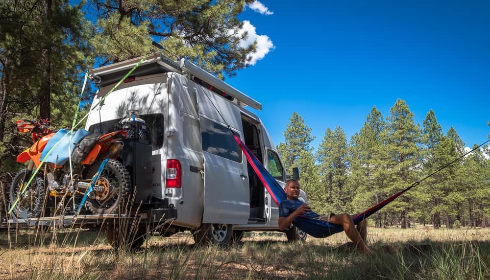
For one or two people, a van can provide enough living space and comfort. People who can handle a minimalistic lifestyle, get rewarded with something much bigger - the great outdoors.
Follow links below to skip to desired section:
The Most Memorable Places
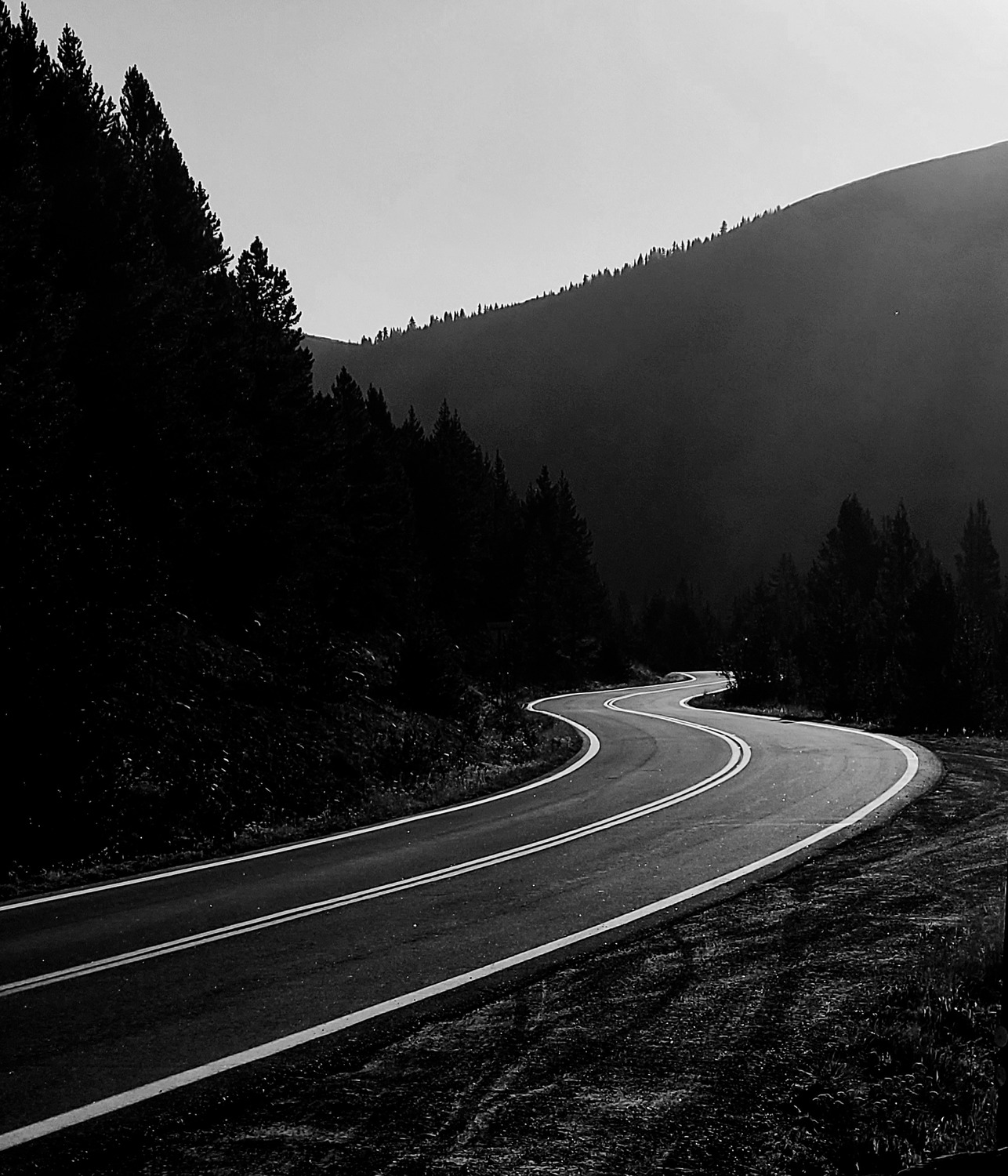
The call of an open road.
In terms of sheer beauty and opportunities for recreation, US west is hard to beat. These are some of the most memorable places I've visited with the van:
Colorado Rockies
While Colorado Rockies are beautiful no matter where one goes, for me, San Juan mountains are the crown jewel of the Rockies. The cute town of Ouray is the adventure central of the area - hiking and motorsports in the summer and ice climbing in winter. Nearby, well-preserved, old mining town of Silverton offers a glimpse into days long gone and is connected by an old steam engine train with Durango.

Million Dollar Highway from Ouray to Durango in the autumn.
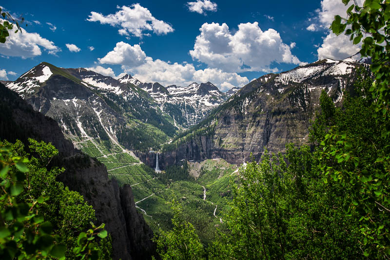
View of Black Bear pass descending down into Telluride in early summer.

Even in June, high alpine lakes of Colorado are frozen. Some people put heaters in their vans and enjoy sub-zero temperatures. Not me, I prefer hot weather.

Sunset atop the Loveland pass.

Propane powered portable fireplace is perfect for chilly evenings.
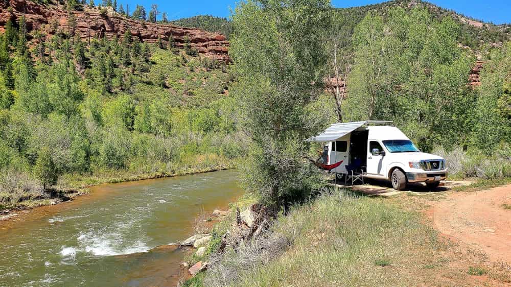
Many places are crowded, but it's still possible to find a secluded scenic spot - alone next to San Miguel river in San Juan Mountains.
Colorado Plateau

This is where people go to experience America's Southwest and see the most iconic vistas. Colorado Plateau occupies chunks of four states - Colorado, Utah, Arizona and New Mexico, centered roughly at the Four Corners.
Some of the places not to miss on the Grand Circle are listed below, but this area has so much more to offer.
- Arches National Park
- Bryce Canyon National Park
- Buckskin Gulch
- Canyonlands National Park
- Capitol Reef National Park
- Grand Canyon National Park
- Grand Staircase Escalante
- Mesa Romana
- Monument Valley
- Slot canyons
- The Wave
- White Pockets
- Zion National Park
Utah's "Big Five" are obviously the main attraction here and they draw huge crowds. Despite the vicious crowds, these parks are a must. Luckily, there are many more places to be enjoyed. For more inspiration check out Utah's official site .

Only a few hours drive from the frozen lakes of Colorado, in the desert of Utah, it's warm and pleasant. Solar panels and house batteries provide enough of power for fridge, espresso machine, pressure cooker and gadgets.
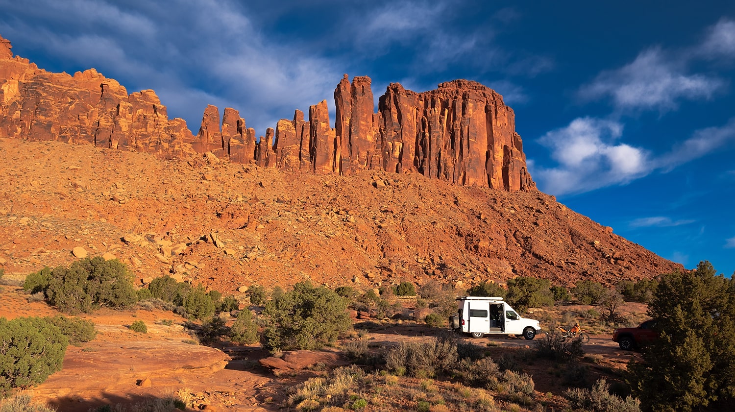
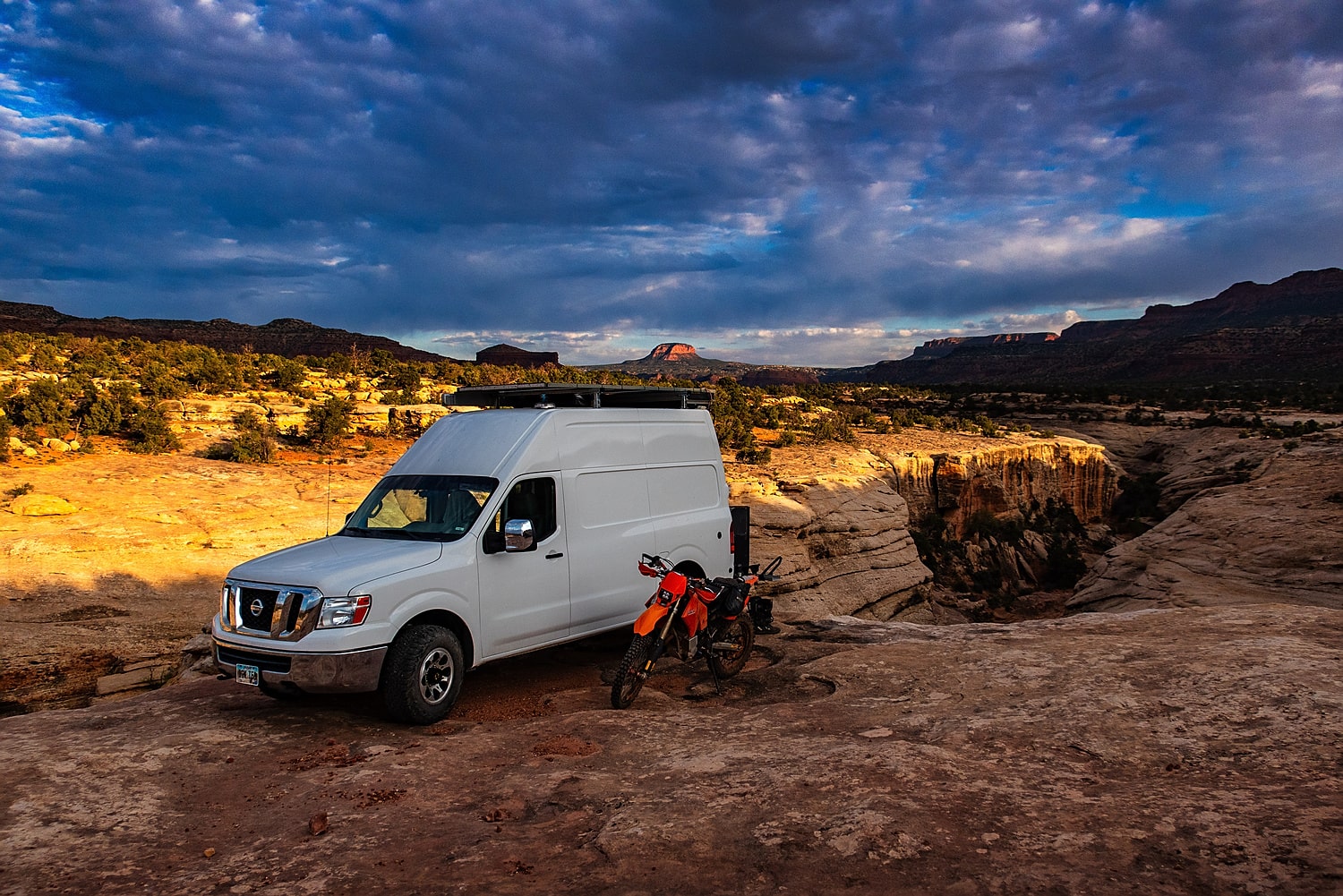
Moab Area
When it comes to desert enduro riding, Moab is hard to beat. Spectacular jeep trails climbing canyon walls, snaking along cliff edges and traversing challenging ledges are unique proving grounds for motorcycle riders.
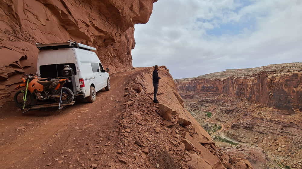
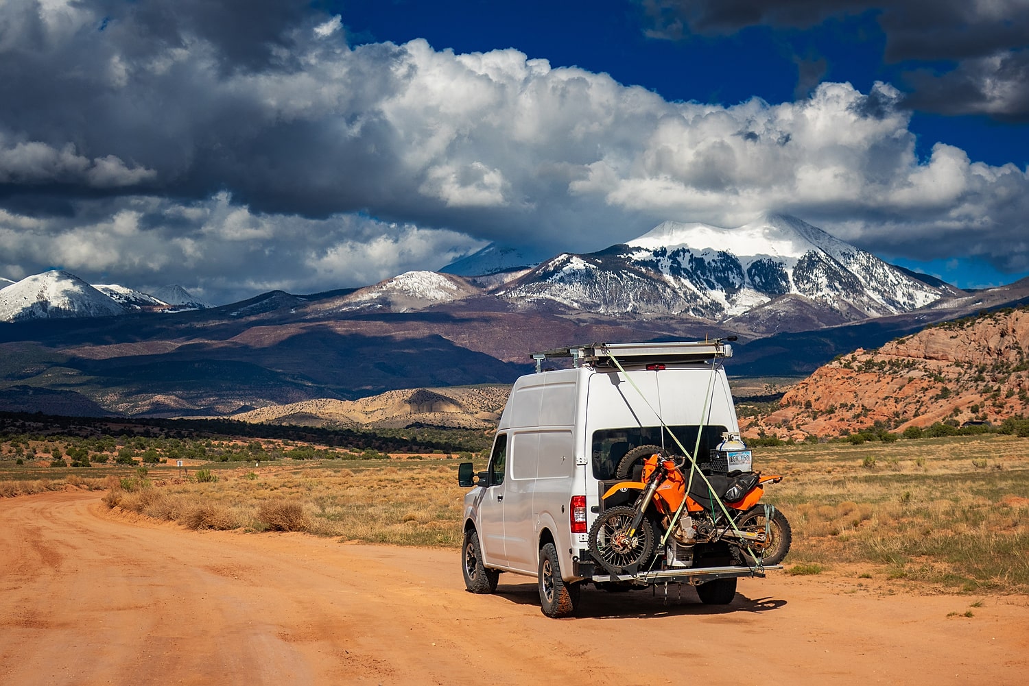
High clearance and 4-wheel drive can help getting to some scenic places.

Camping and riding the canyon country, Utah
Scenic camp site outside Moab, Utah
Another camp in Indian Creek area outside Monticello.
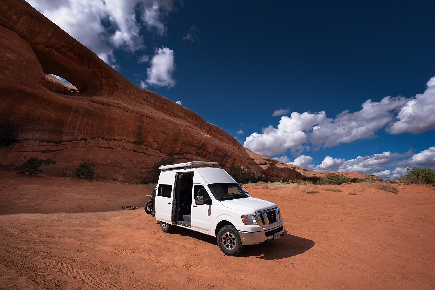
Behind the Rocks area outside Moab.
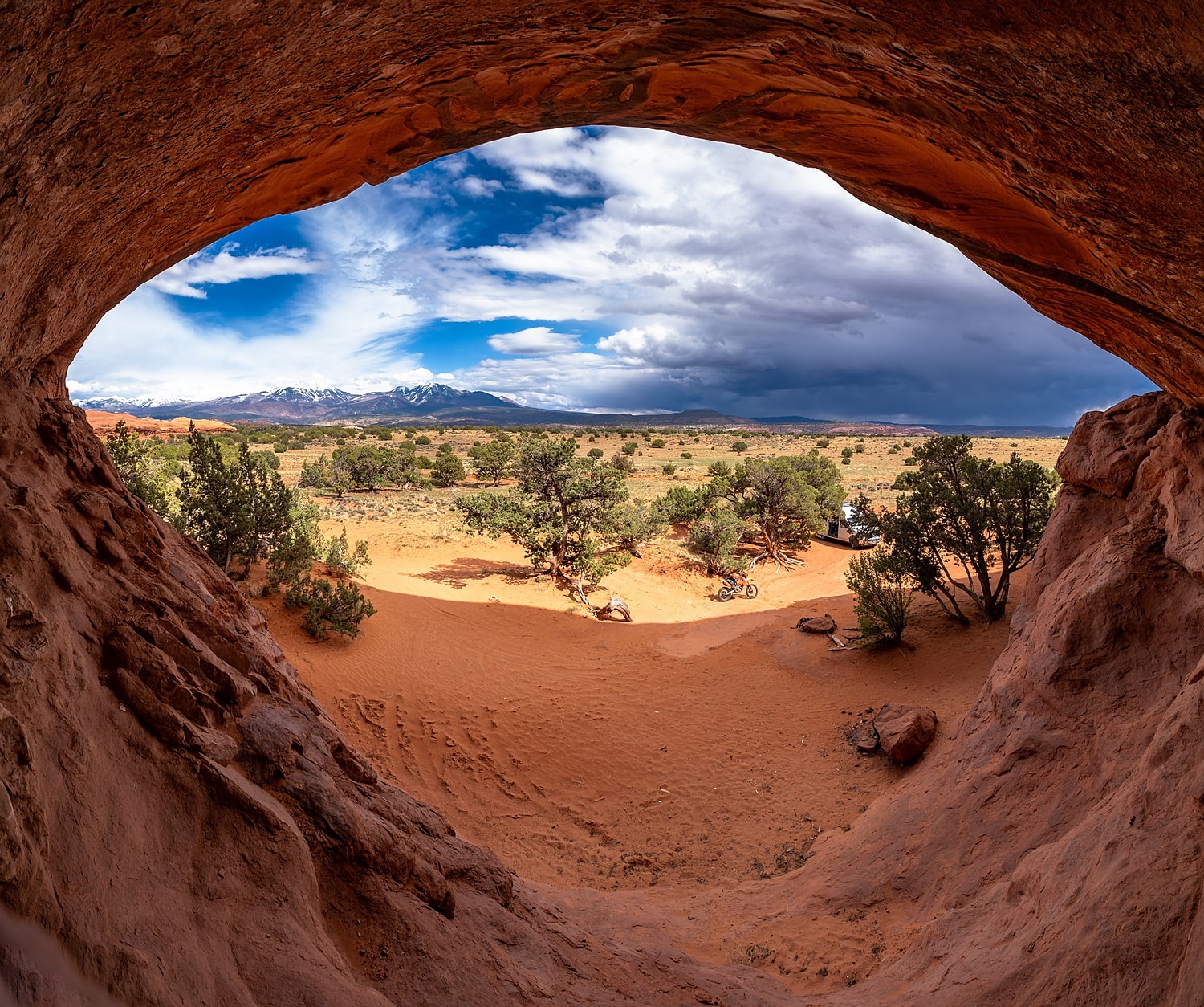
A cave off Behind the Rocks trail.
Camping in Bear's Ears NM, Utah.

Remnants of Uranium mining boom in Bear's Ears NM, Utah.

Cock's Comb Ridge, Utah.

Indian ruins can be found in almost every side canyon off Buttler Wash, Utah.
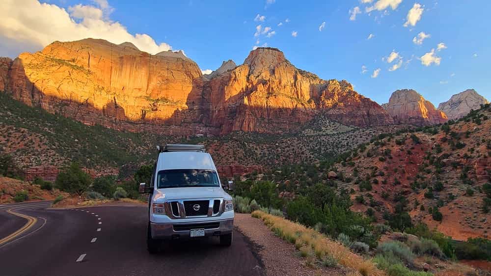
It is not possible to drive on the dead-end road inside the Zion Canyon any more. But the drive on the through road is spectacular enough.

Morning clouds over the Zion as I am driving out of the park.

Chilling in Virgin river in Zion NP.

Blissfully peaceful Narrows, after all the crowds are gone.

Slowly making my way back to the camp.

Vicious crowds just an hour earlier.
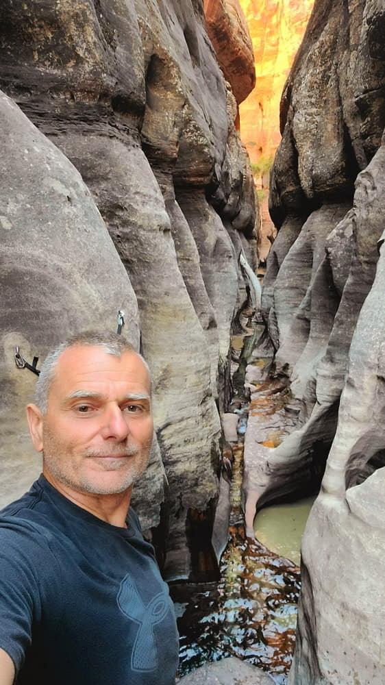
Luckily, solitude can still be enjoyed in many canyons.
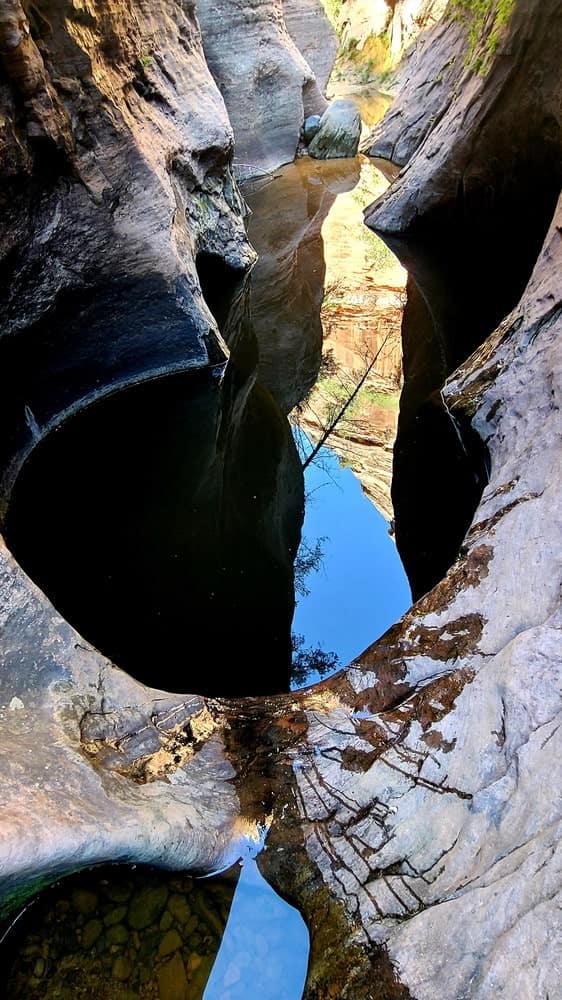
Some of the pools are deep, requiring swimming in frigid water.

The famous Subway.

Millions of years of mother nature's sculpting at display.

Sun peeked below the clearing storm clouds just before setting over Grand Canyon.
Chilling in Grand Canyon during mid-day heat.

Another beautiful sunset in Grand Canyon, but from the much less crowded North Rim.

Easy hiking along the southern rim of Grand Canyon.
Northwest Pacific

California Redwoods in a typical morning fog.
US Northwest is incredibly beautiful, one can find deserts, glacier covered peaks, rainforests and endless beaches. However, for someone who abhors rain, it can be a tricky destination. Last time I rode to the NW, I was chased by a major storm for 1500 miles, all the way to southern Utah.

Admiring giants in Del Norte State Park.
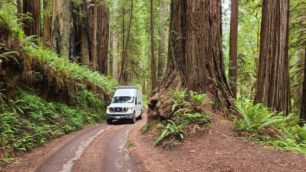
Exploring Prairie Creek State Park.
I started driving along the Pacific coast in Ft Bragg, While the temperatures inland were over 100 F, by the coast, it was outright cold, even in the sun. Things did not improve when I crossed into Oregon. But then an unusual "heat wave" came through the NW. While most locals were trying to survive 100 degree days, I could finally enjoy Oregon's beaches.
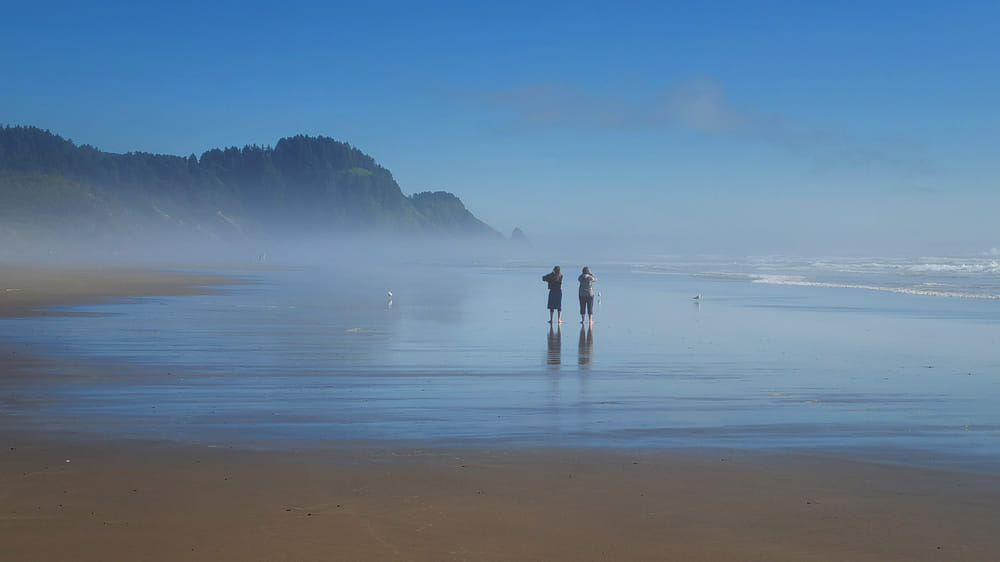
Tranquil beach in Oregon.

I could not figure out if this stump just "landed" or was it a stump of the tree that actually grew right at the beach.

Oregon beach, beautiful but cold.
Washington
Washington's Olympic peninsula is a home of America's only temperate rainforest. A famous hike along the Hoh river has been on my bucket list for years, I finally got to do it with a friend. We hiked 18 miles along the river, all the way to the lateral moraine of the glacier on Mt Olympus.

On the hike along Hoh river.

No problems finding drinking water on Hoh trail.
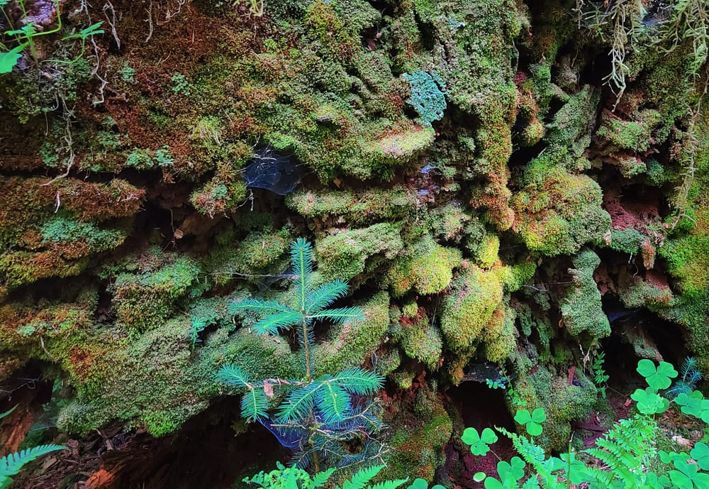
Every dead tree is home to numerous new plants.

Hoh trail winds through a moss covered forest most of the way.
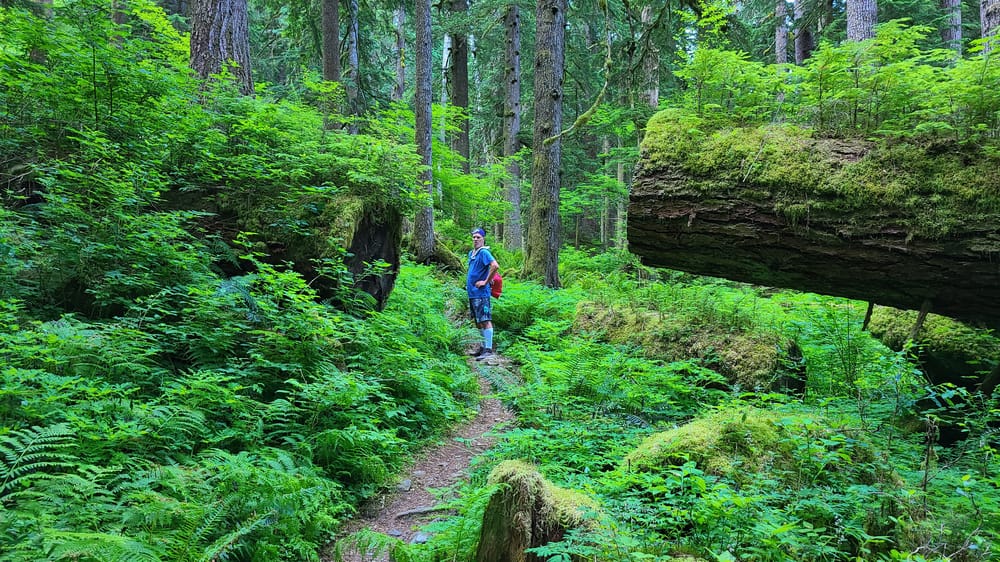
Fern, moss and lichen.

A moss covered tree near Lake Crescent.
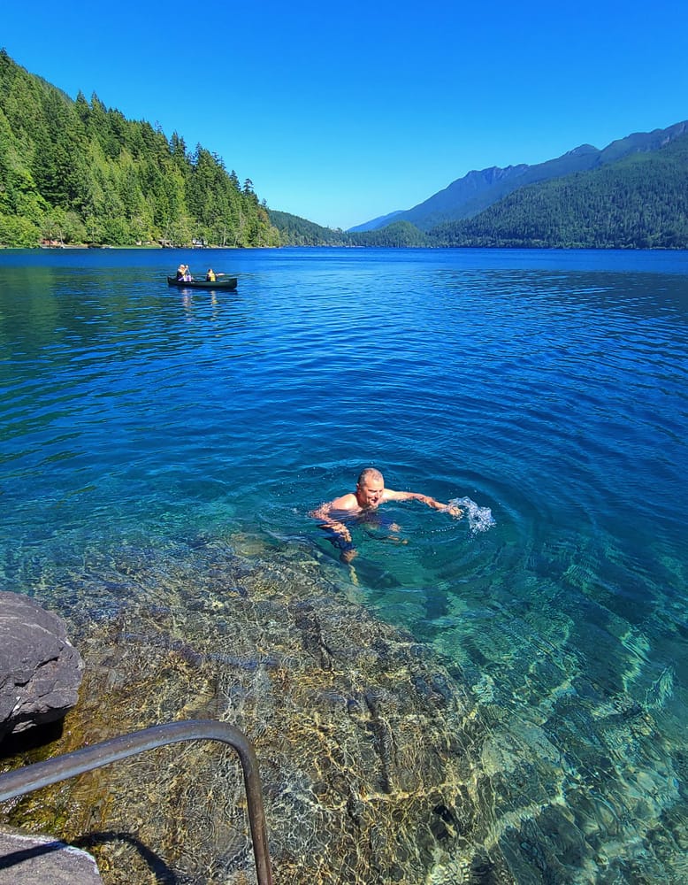
Going for a dip in crystal clear waters of Lake Crescent, the largest lake on the peninsula.
Beaches of the Olympic peninsula are also a big attraction and home to a few famous hikes. Unfortunately, because of Covid, many beaches were not accessible.

Driftwood strewn beaches of the Olympic peninsula.
< picture>
Rock stacks on the famous Ruby beach.
Mt Rainier is only half a day drive from the Olympic Peninsula. I did a few day hikes there as a preparation for the longer hike along PCT in the Cascades.

Couldn't resist the crystal clear water of the Crescent Lake.

At Mt Rainier.

Snow cave along the skyline trail on Mt Rainier.

Creeks are cranking, carrying glacial melt from Mt Rainier.

Chilling at Sunrise point of Mt. Rainier.
Hiking a Section of the Pacific Crest Trail
Pacific Crest Trail goes over 2000 miles from Canadian to Mexican border, passing through some of the most stunning scenery. I did just one section, 74 miles long (according to a sign). My friend and I were dropped off at Stevens pass off US highway 2 and hiked south to Snoqualmie pass on I-90. There were a few hairy river crossings, quite a bit of elevation change, but the biggest challenge, by far, were the mosquitoes. We were bitten everywhere and all the time. Later on, a local lady told us that July is the worst time to hike as far as mosquitoes are concerned.
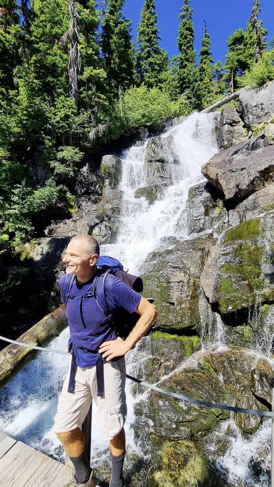
A waterfall along PCT.

Moonrise over Mt Rainier.

The trail is littered with fallen trees. Because it's a wilderness area, chainsaws are not allowed, so the crews cut and clear fallen trees like it was done 200 years ago. Doesn't seem like the best use of tax dollars.

Foggy mornings give that true feeling of being in the Northwest.
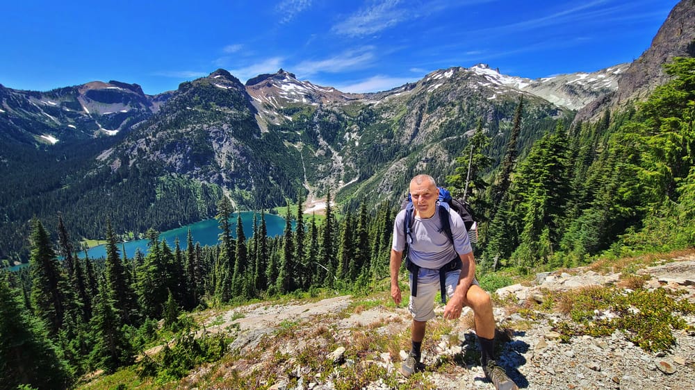
Just one of many pristine alpine lakes along the trail.
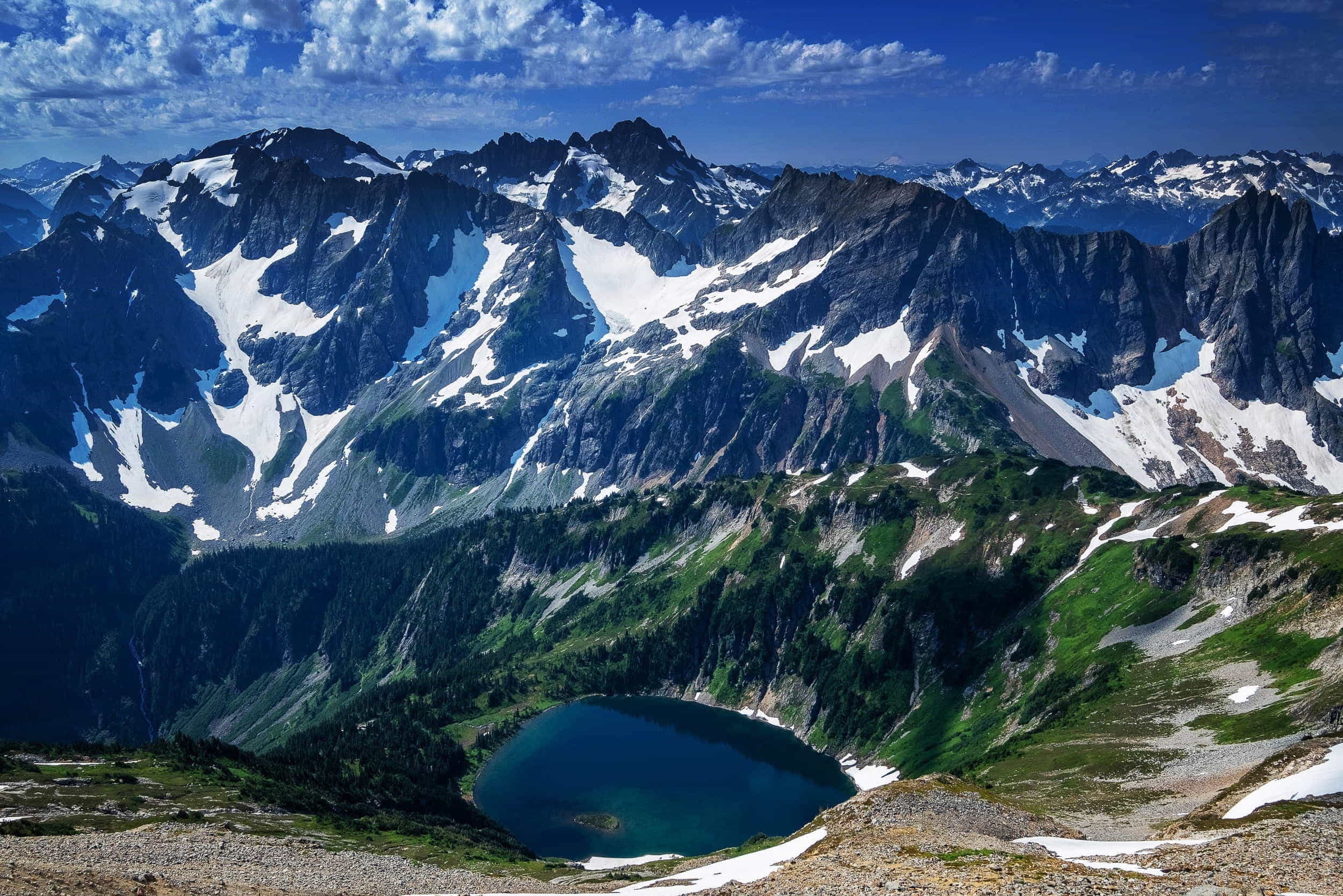
A lake in North Cascades NP.

My campsite at Mt Baker.

Road into the North Cascades NP.
After the hike, my friend and I decided to explore the eastern side of the Cascade mountains. I also wanted to ride some famous single track motorcycle trails near Cle Elum. So we setup a camp by the Cle Elum lake.

Camping at the edge of the Cle Elum lake.

Cooling off in a creek.
Wanatchee National Forest has many great motorcycl trails to ride. Some are fairly easy, but most were at the limit of my abilities. After a few days of excellent riding, I ended up on a trail littered with fallen logs. It turned to be a much bigger adventure than I had planned for.
Idaho
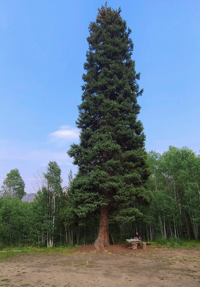
Idaho, the potatoes state, as proudly shown on state license plates, was off my radar for years. What a shame as it is my favorite state now. There are no national parks, or any breathtaking sights, but lots of beautiful forests, canyons, rivers, lakes and, the best of all, lack of crowds.
Passing through one village in Idaho, I saw a sign "Redneck Home." Rednecks they may be, but boy, do they know how to make beautiful campsites! One campsite is more beautiful than the other, one gets spoiled with choices. There are many pit toilets in national forests and they are cleaner than anywhere else I've been. Thumbs up for rednecks and how they take care of our public lands.
A stark counterexample comes to my mind from California's Big Sur where a section of the national forest has been closed off due to wide-spread public defication. So much for "progressive, tree-hugging Californians."
Sipping morning coffee while listening to the gushing river in Idaho.

Old cars and trucks along a highway in Idaho.

One of the most memorable spots - Upper Payette Lake.
Working on my project in Idaho mountains.
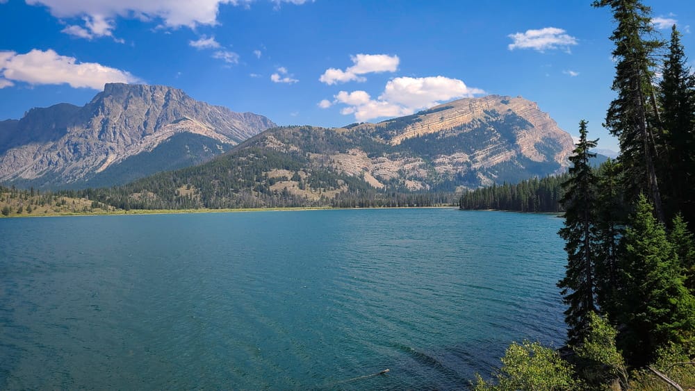
Wyoming and Montana - The Cowboy Country

The Grand Tetons.

Solitude lake trail follows a gushing creek.

A waterfall just below Lake Solitude.

The trail passes Wigwams (that is the name of the peak).
As beautiful as Grand Tetons are, crowds simply spoil the experience. I ended up in Wind River Range in search of solitude. I was not alone, but compared to Grand Tetons, it felt as if I was the only person there.

Happy to be away from the crowds.

We hiked along a wide valley following the Green River.
One of two big lakes that the Green River flows through. No wonder the area is called Green River Lakes.

Chilling at Killpecker sand dunes, ( yes, it's a real name!)
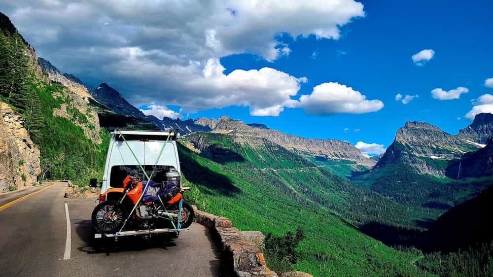
Going to the Sun road, Glacier NP.

Waterfalls in Glacier NP are cranking in July. Many trails are still blocked by snow.
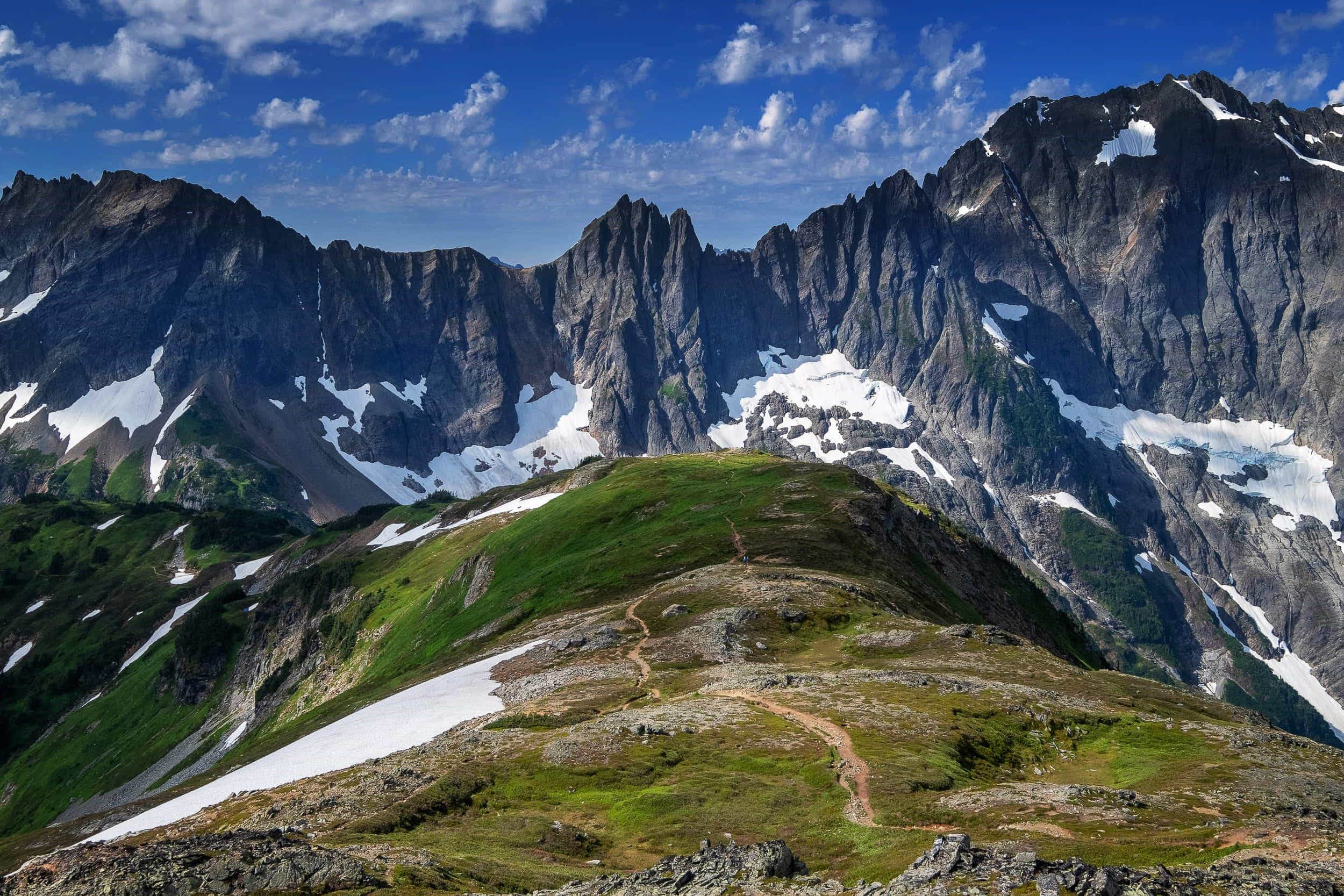
Canadian Rockies
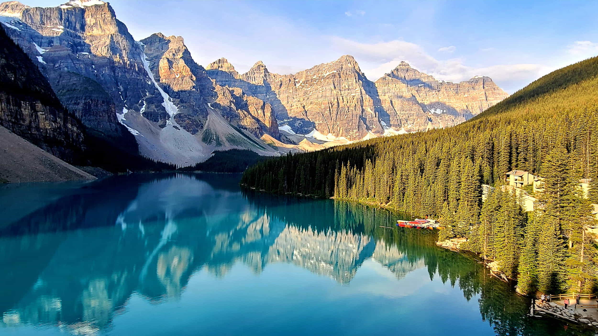
Moraine Lake has become a major hassle to get to. I had to wake up at 2 am to drive in before they start controlling the traffic in.
The most spectacular part of the Rockies is in Canada, roughly from town of Canmore up to Jasper. I used to go there twice a year, once in winter for ice climbing and once in summer.
It's been a while since I visited this part of the world. Crowds have gotten so bad that at several places, I simply turned back. This, unfortunately, soured the memory of this trip. Several days of incessant rains did not help the experience.
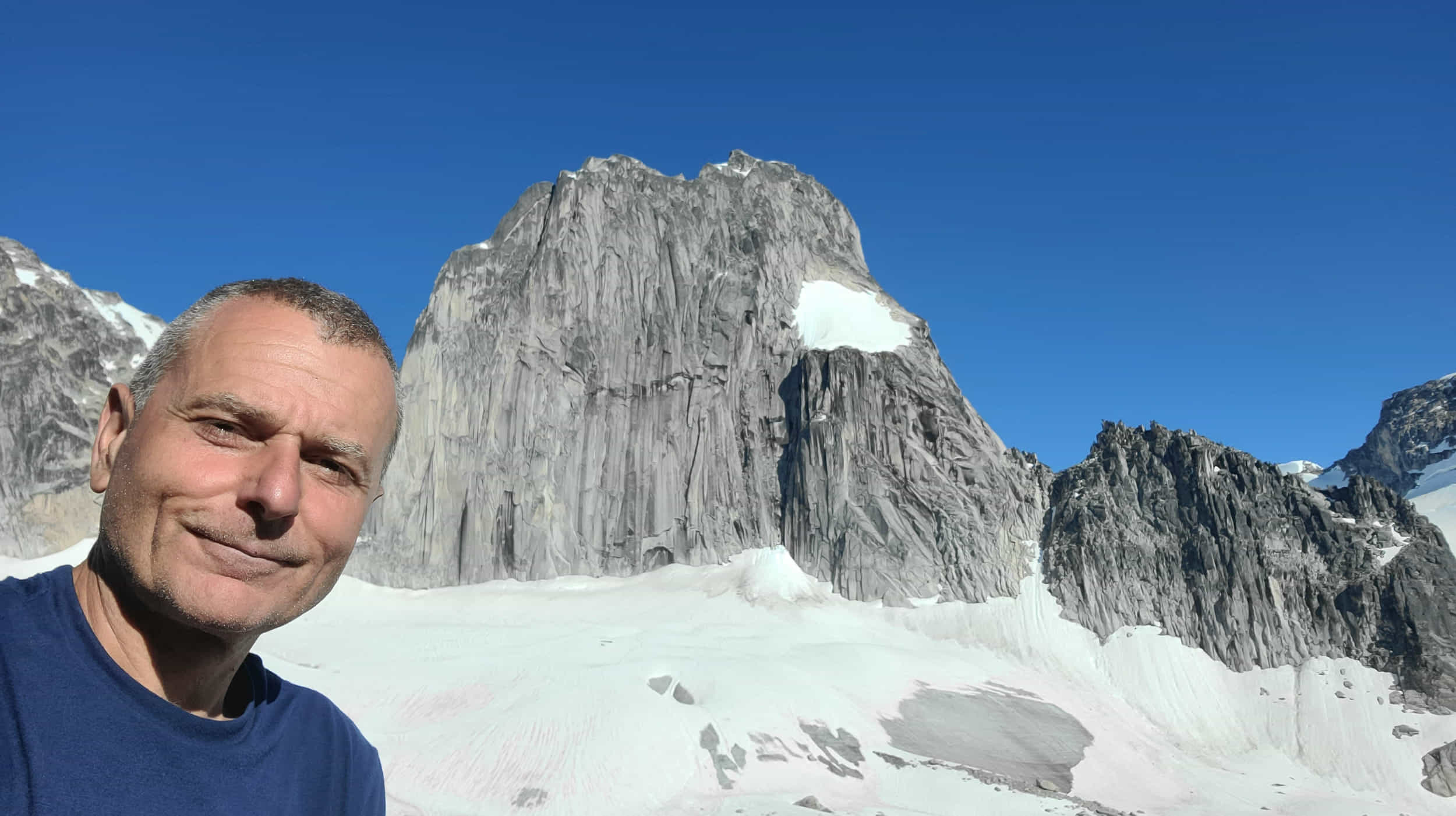
I hiked up to Bugaboo spires.

Lovely spot to relax to the thundering sound of a waterfall.
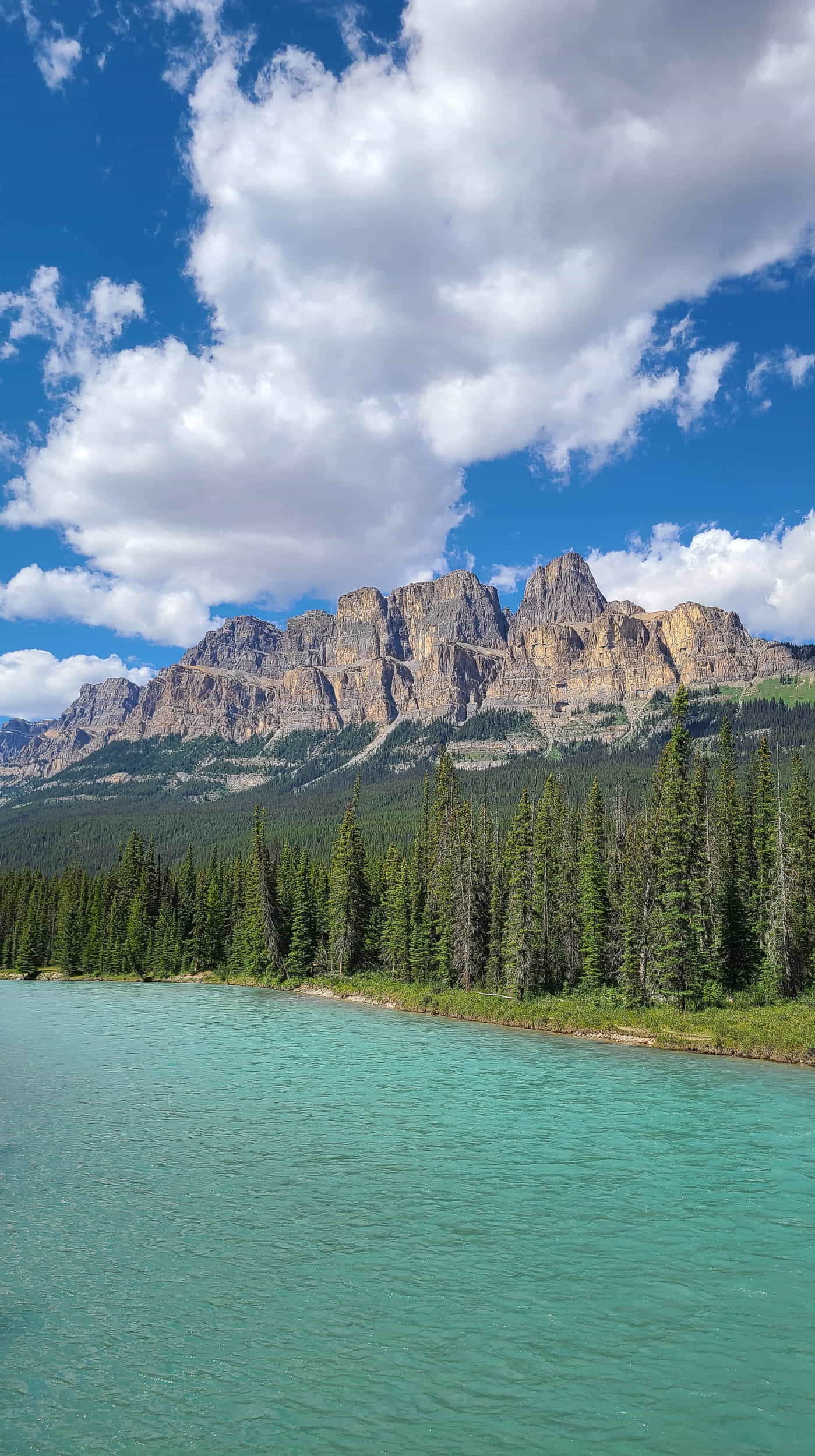
Castle Mountain from Icefields Parkway.

Takakkaw Falls, the second highest in Canada.
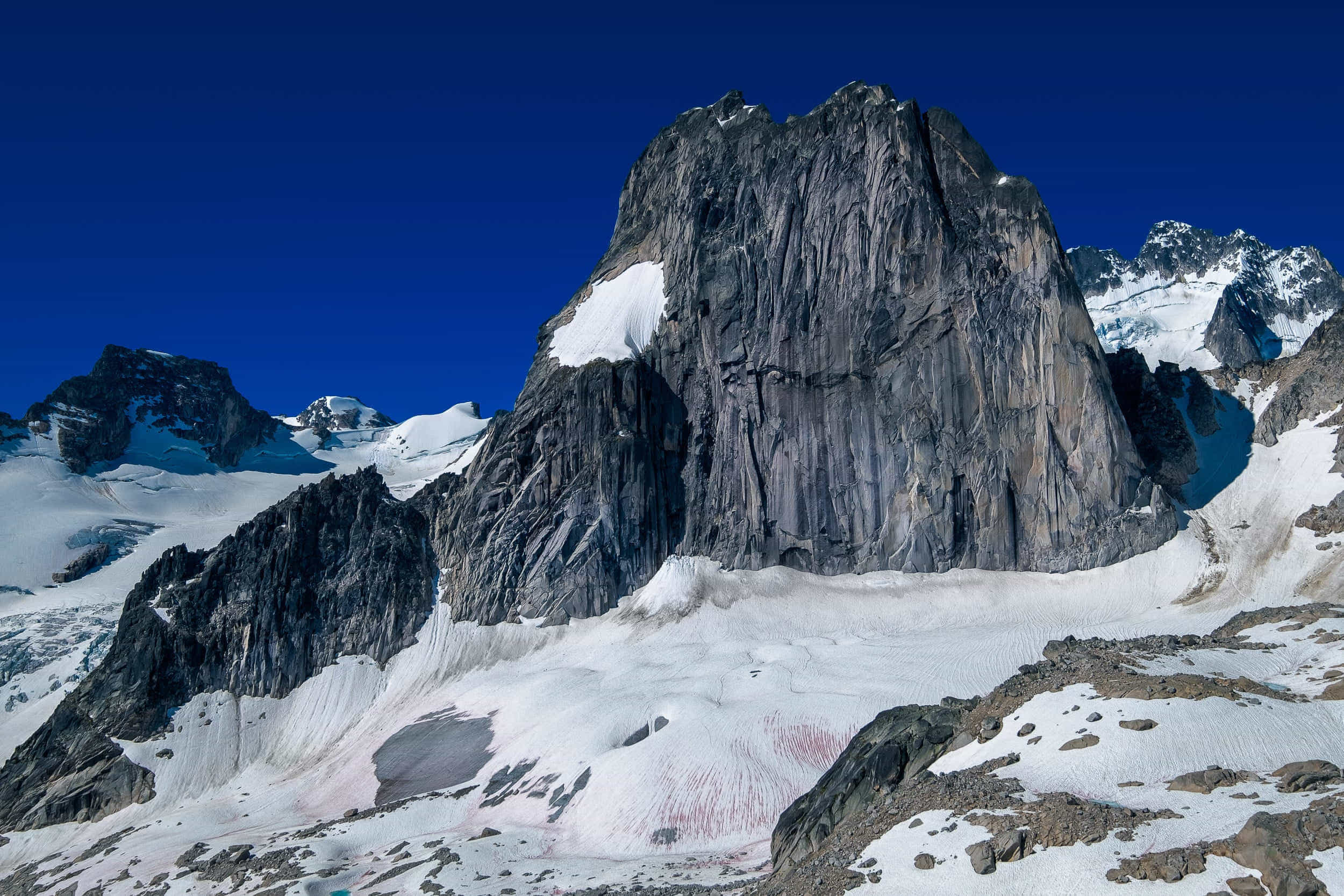
Bugaboo provincial park.
Trail to Cobalt Lake.
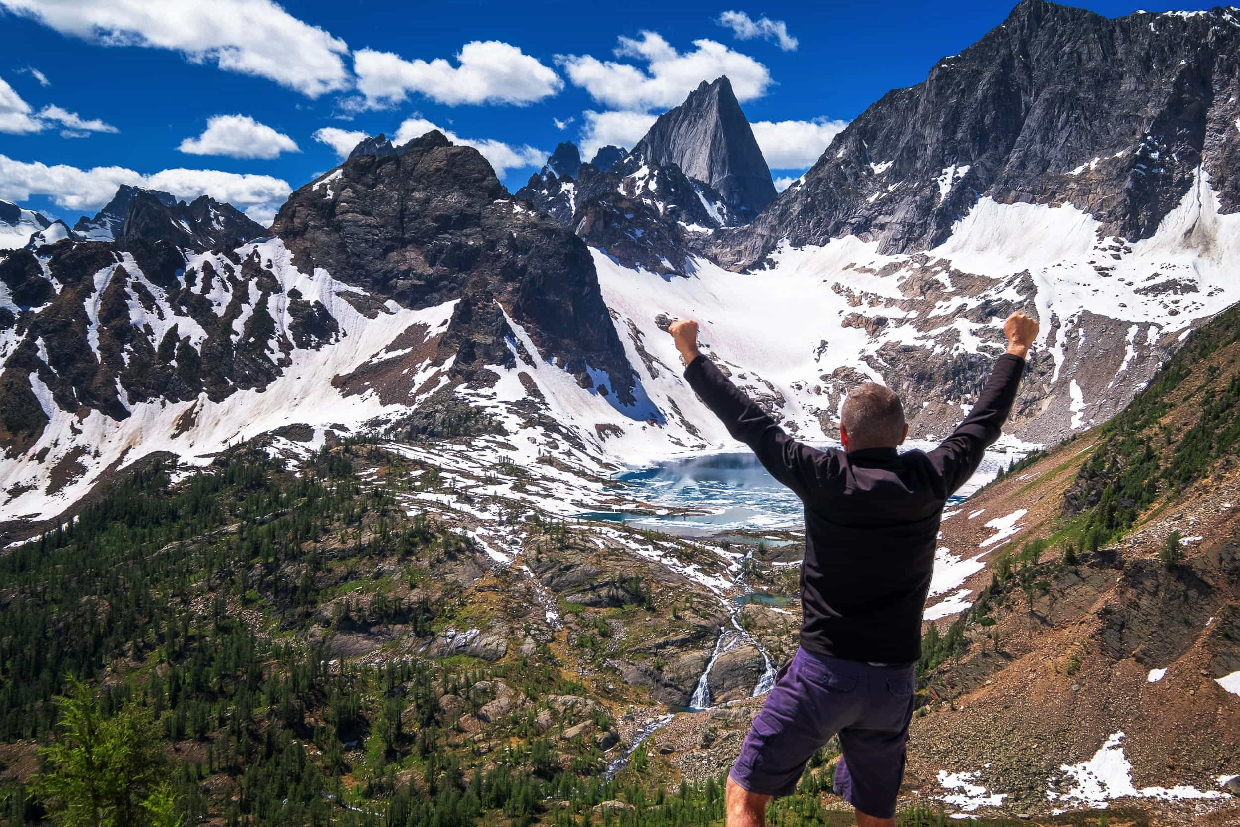
Cobalt Lake.
Van Cuisine

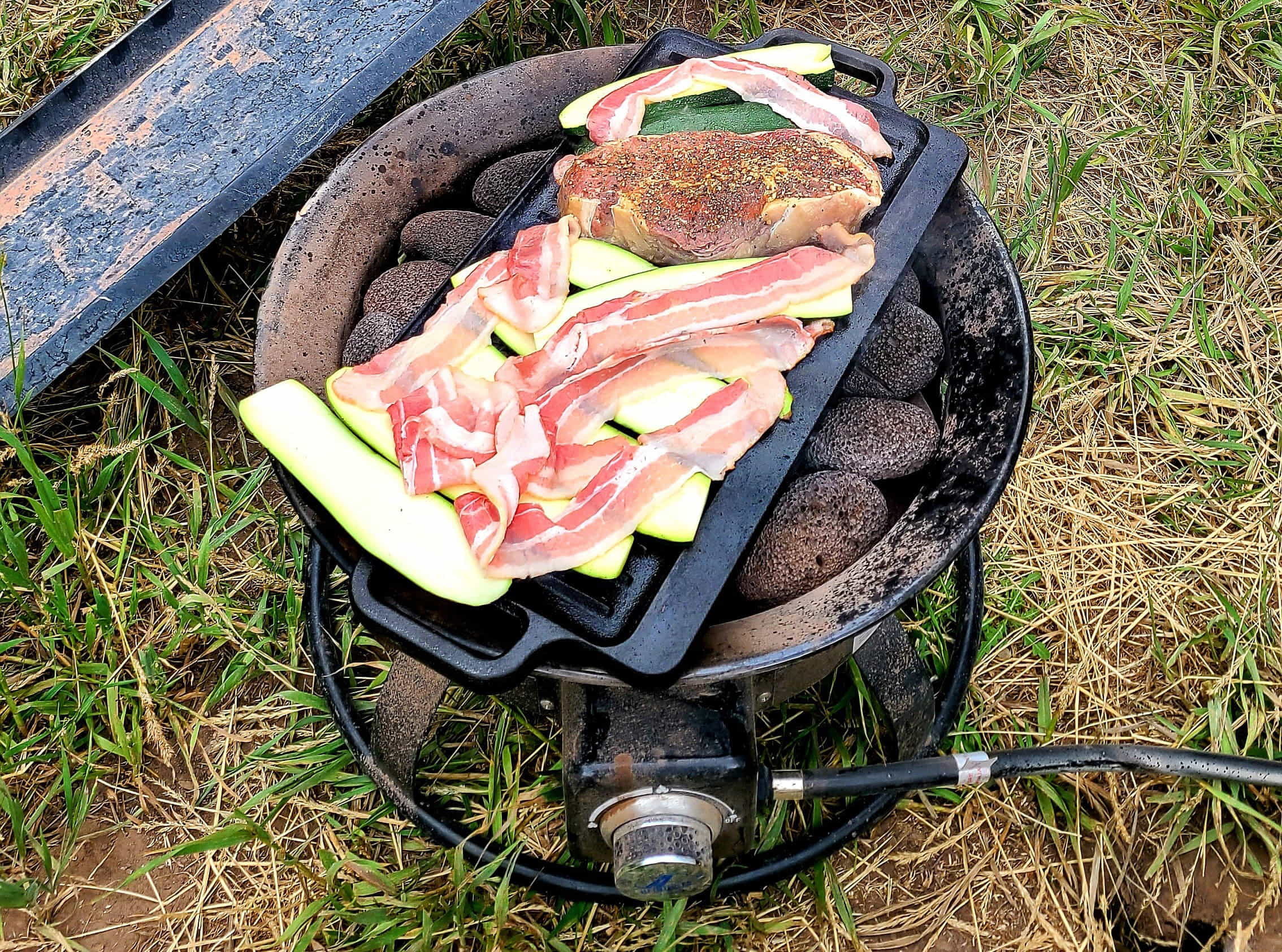
Grilling is the easiest way of preparing food.
Simple, healthy and delicious meals can be easily prepared. Grilling is easiest, but with a pressure cooker/steamer, one can prepare almost any kind of meal.
Going Keto.
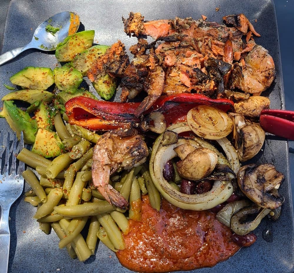
Easy to prepare, healthy and tasty.
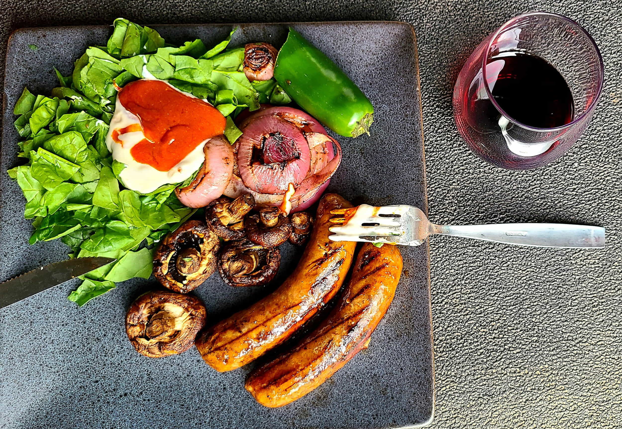
Fresh spinach leaves and sauces add variety.

Sauerkraut is supposedly beneficial for the gut microbiota.
Van Modifications
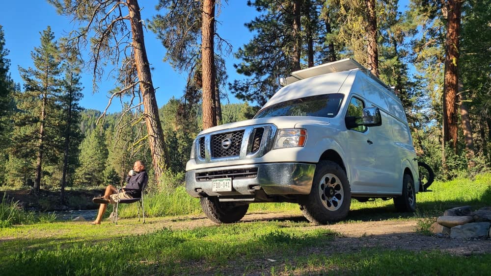
With a help of a friend, his garage, tools and wood it took me 5-6 weeks to make interior of the van comfortable for full-time living.
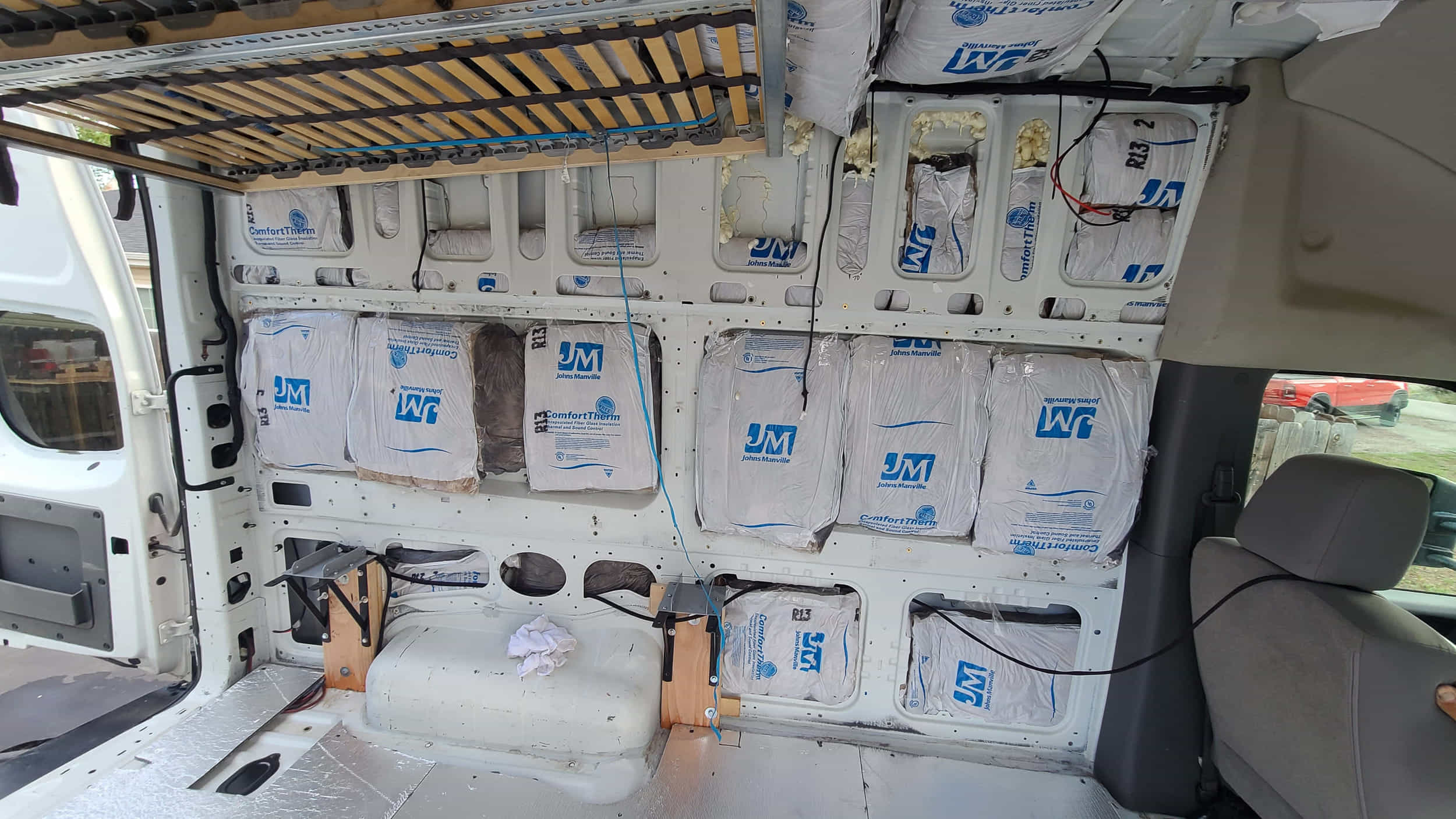
1. Insulate walls and roof.
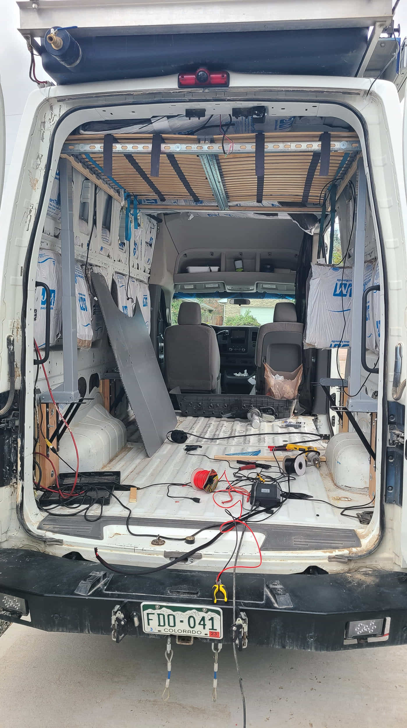
2. Install lifting bed.

3. Install shelves and drawers.

4. Install batteries, inverter, solar charger controller and fuses.

5. Install wooden benches with storage underneath.
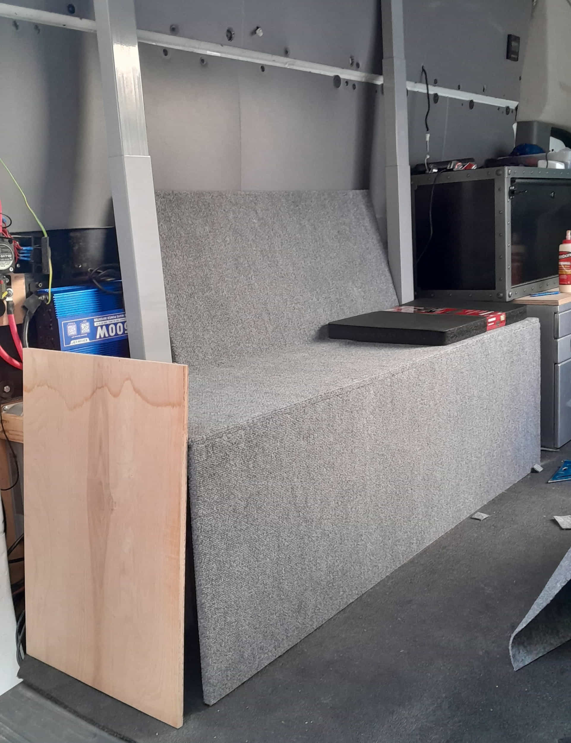
6. Cover wooden surfaces with carpeting.

Bed lowered for sleeping.

Bed raised for day use.
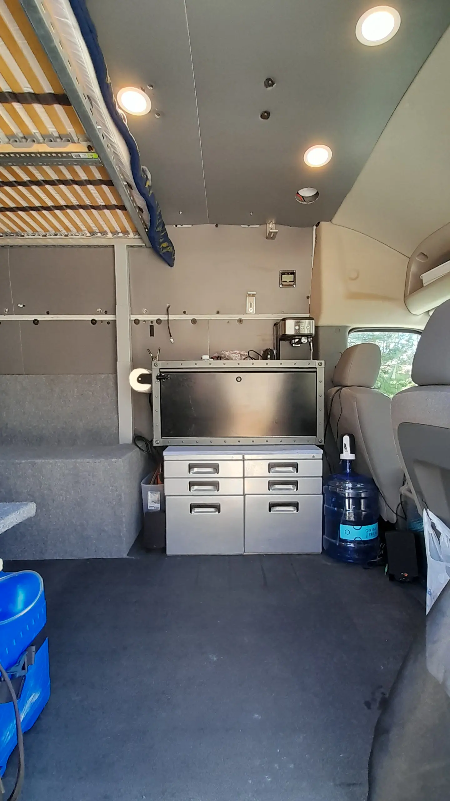
Forward section for food preparation/storage.